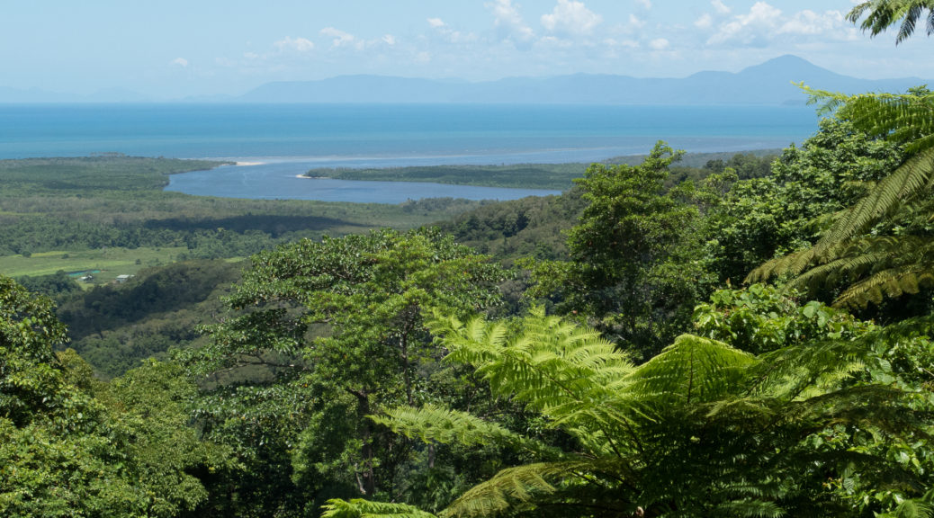
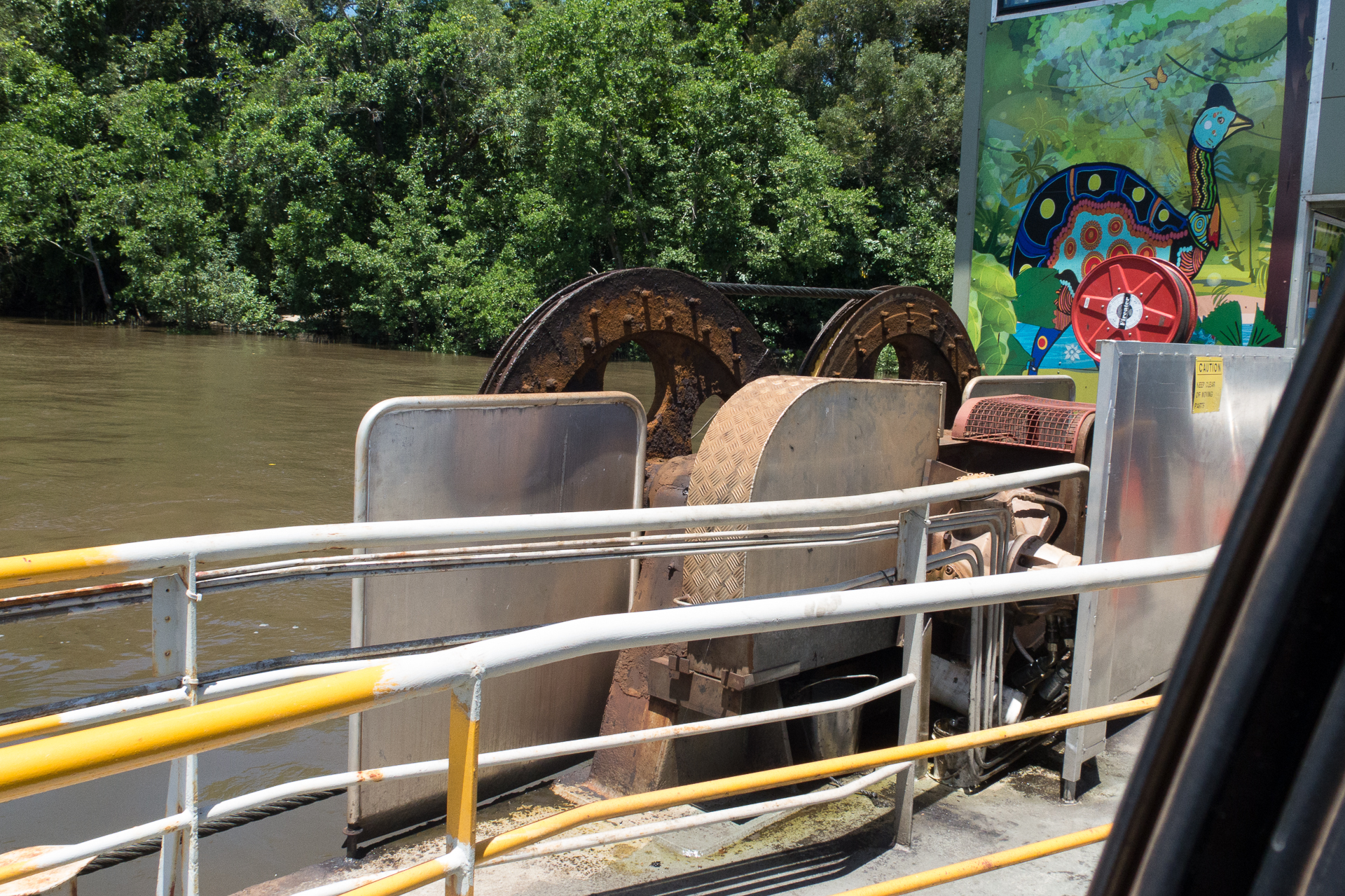
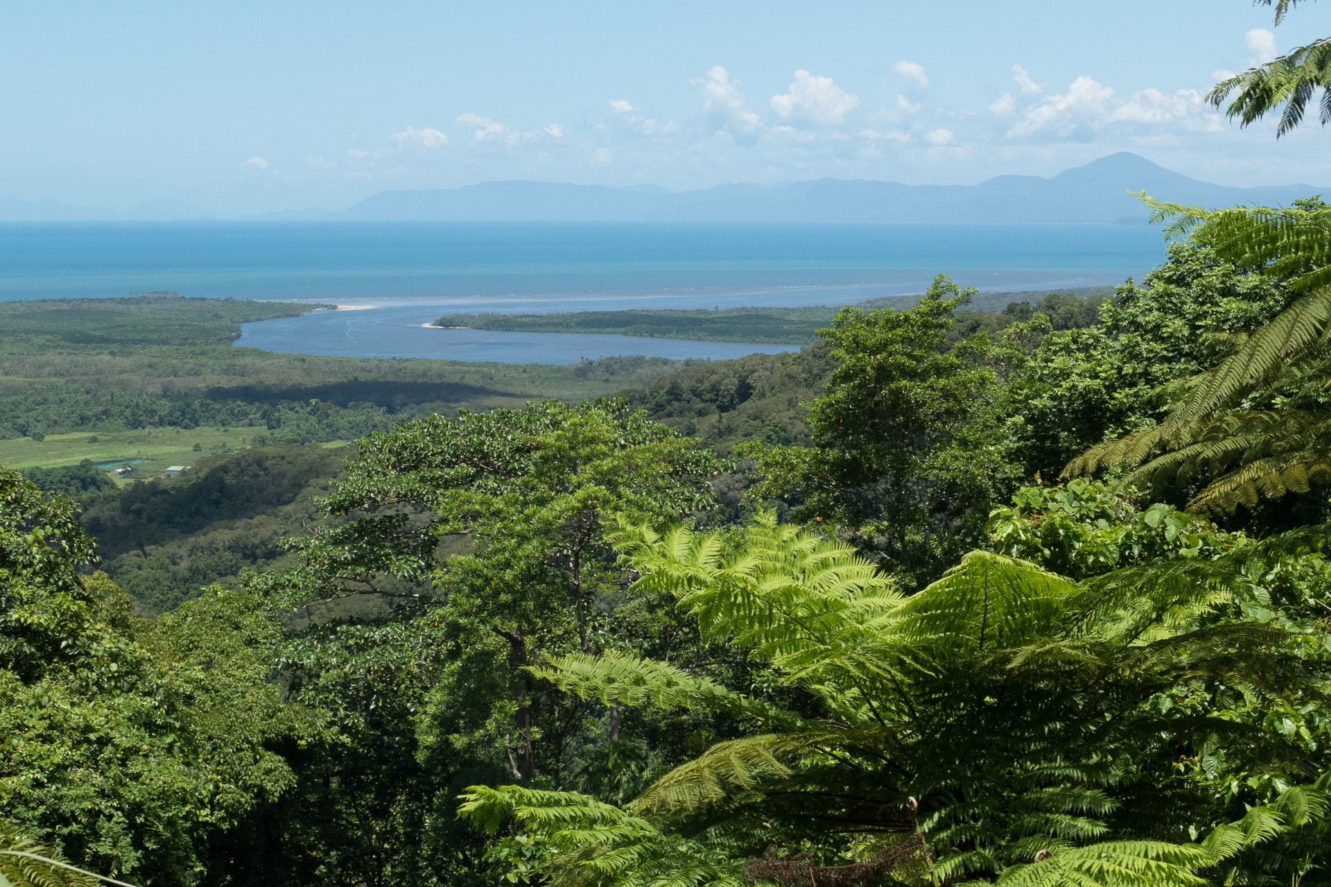
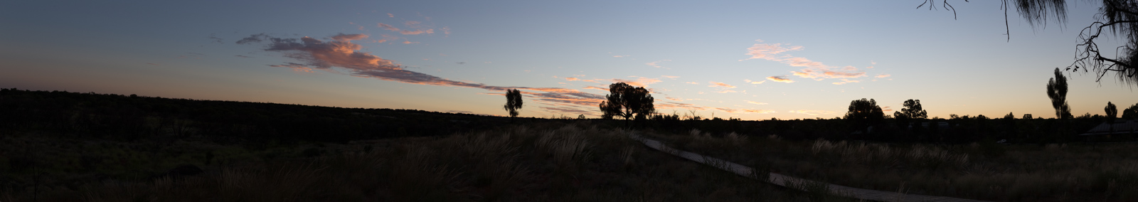
We were approaching our northernmost part of the journey: Cape Tribulation – or Cape Trib as our Aussie friends called it. It wasn’t due to our lack of adventurism or time, which stopped us from going further north. It was Europcar’s contract terms and conditions. So we took the ferry to Daintree National Park, drove the windy road up to the visitor centre and enjoyed the spectacular views while sweating in the moist, damp heat of the tropics.
Ferry to Daintree National Park
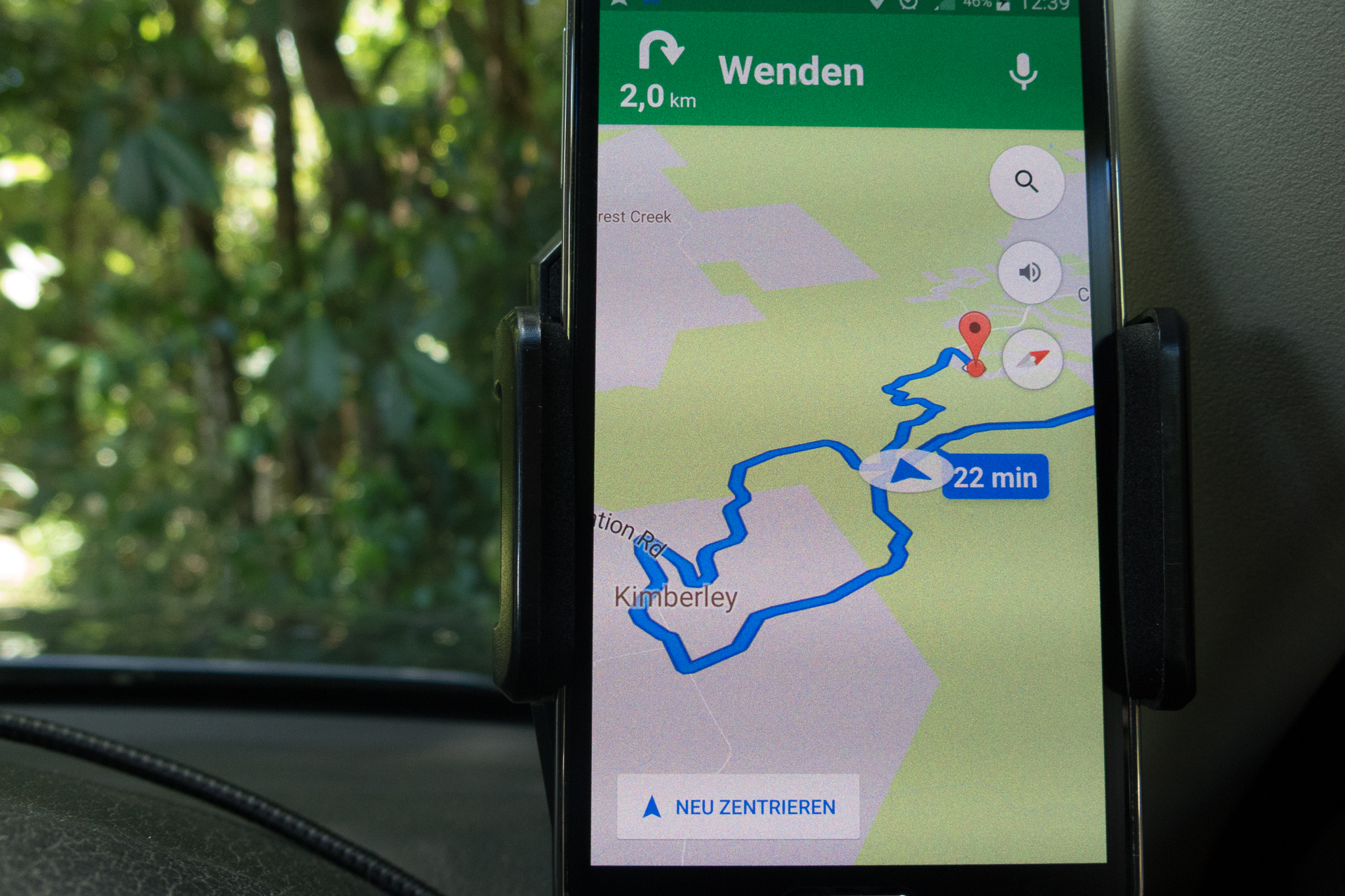
Road to Daintree Visitor Center
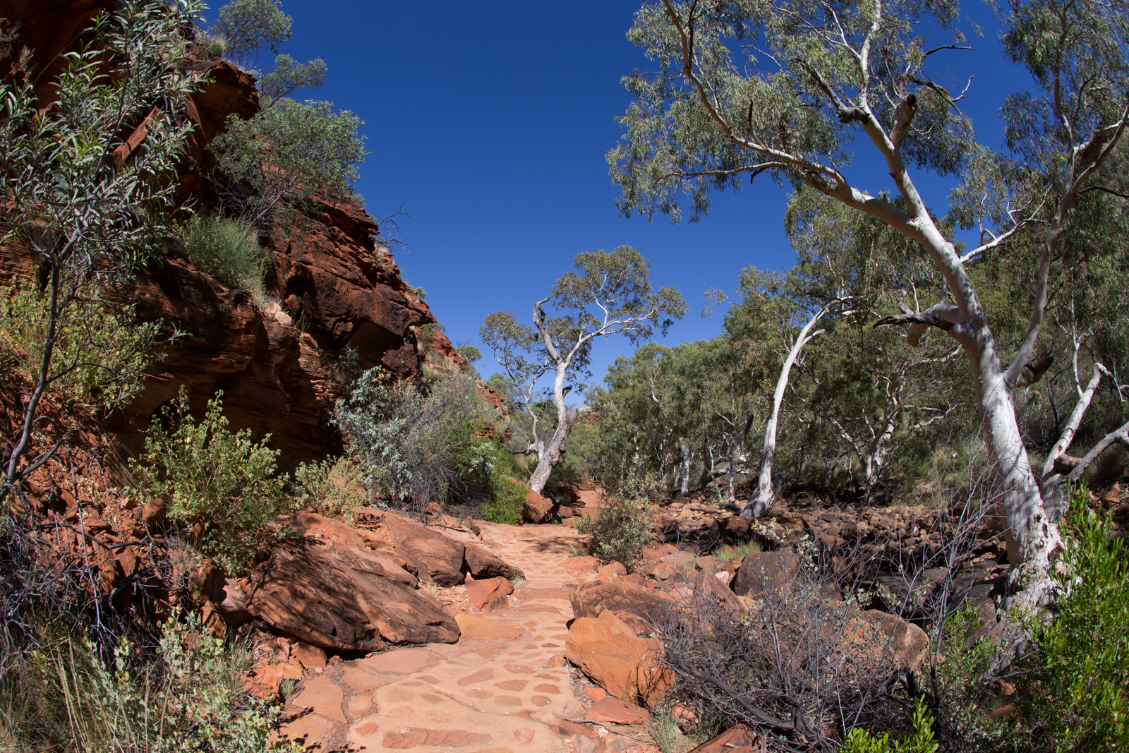
Daintree National Park
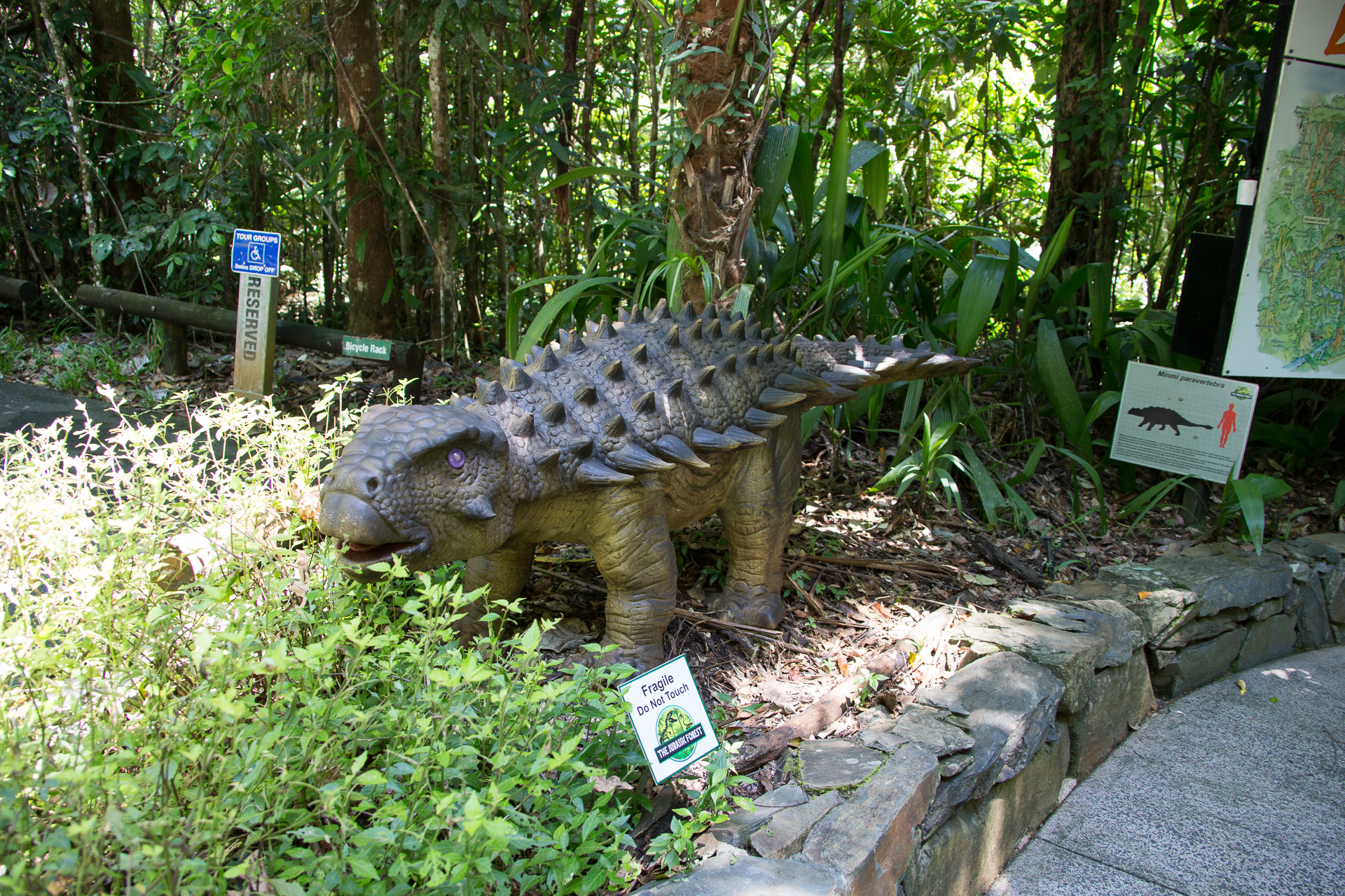
When you visit Daintree National Park, stop by the Visitor Centre and take a few hours to explore the boardwalks there – particularly when you travel with small kids. The walks offer an audio guide and are very entertaining and informative.
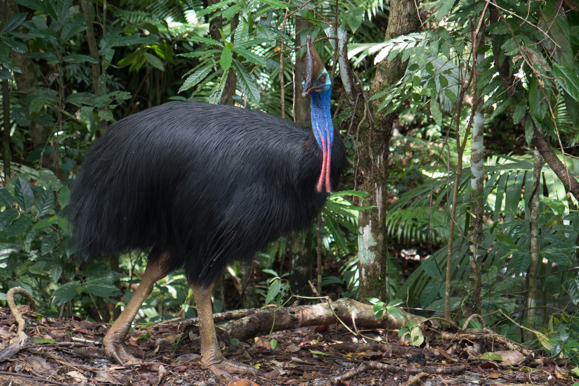
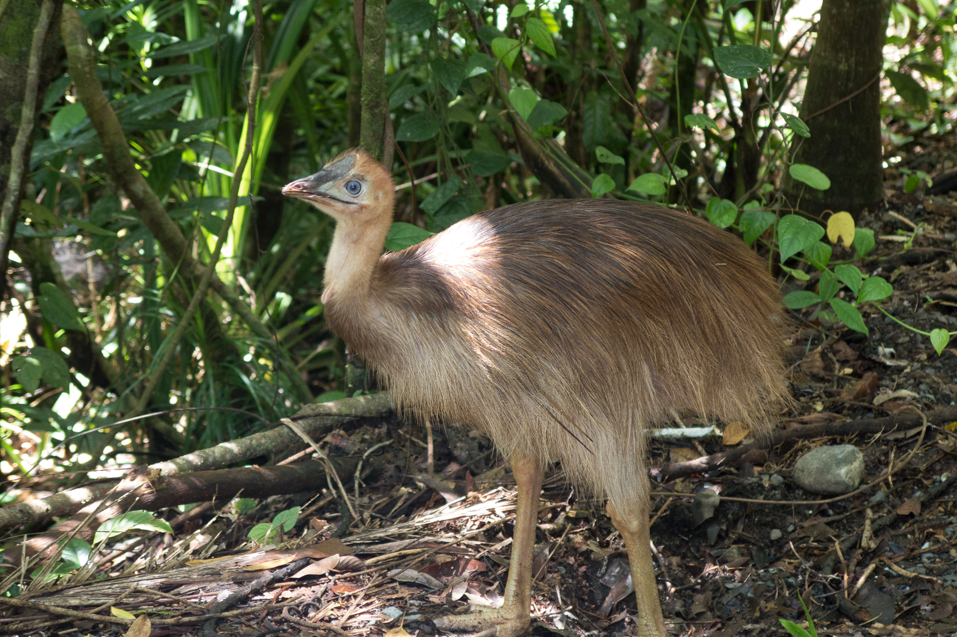
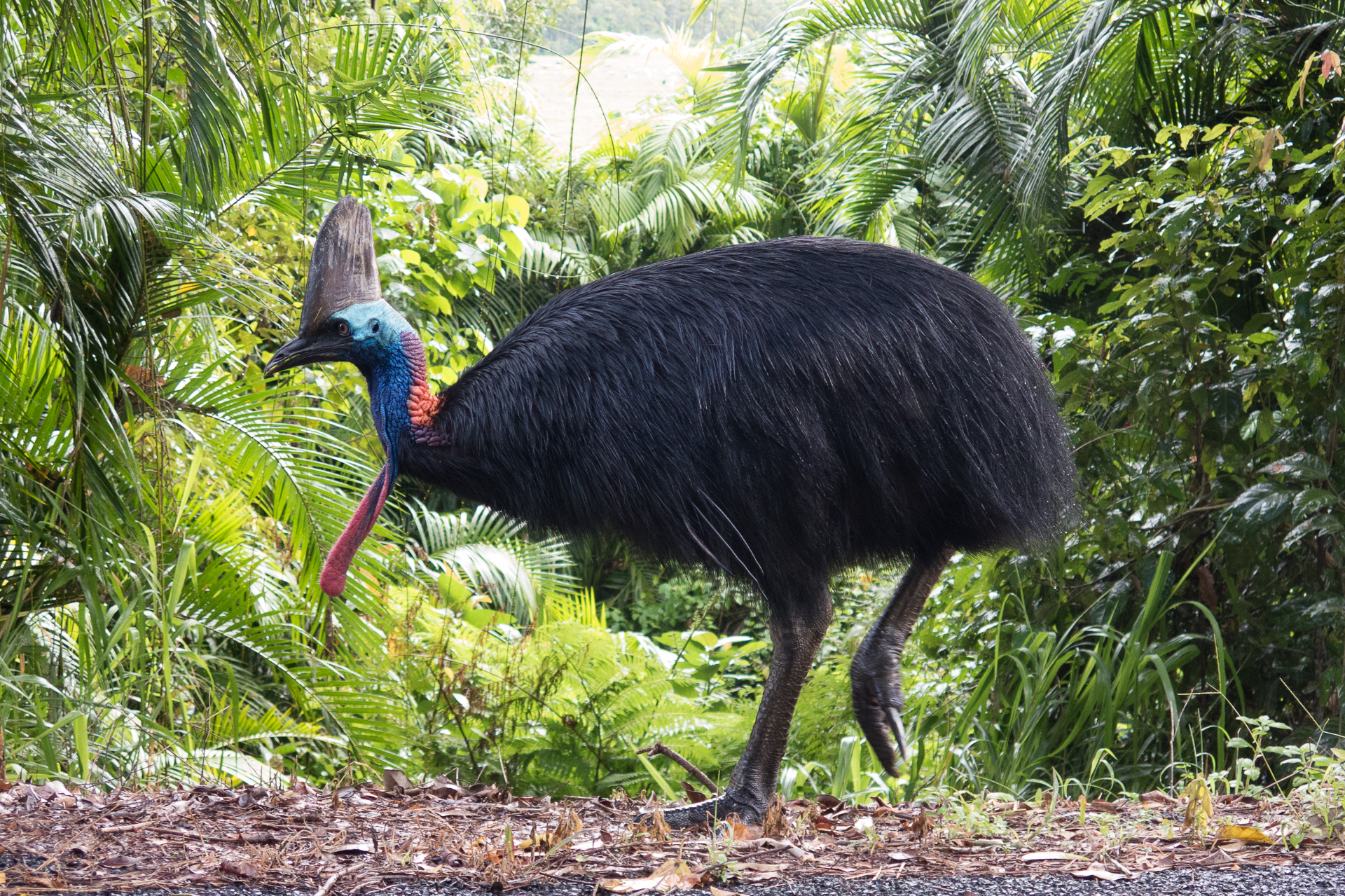
We seemed to have been on the lucky side with Cassowaries. Close to the Daintree Center we saw another male bird guarding a single chick. This brought our Cassowary sightings up to five. Given the total estimated remaining population of this endangered bird is about 1200, we say almost a half percent of the total global population during our journey. We thought this is pretty amazing.
Daintree Visitor Center
Male cassowary
Cassowary chick
Time flew by and we finished the day by getting a good night’s sleep in one of the secluded hideaways. The next morning, we briefly drove by Cape Tribulation beach. But faced with the heat and ‘no swimming’ warning signs of crocodiles and jelly fish, we decided to turn south again.
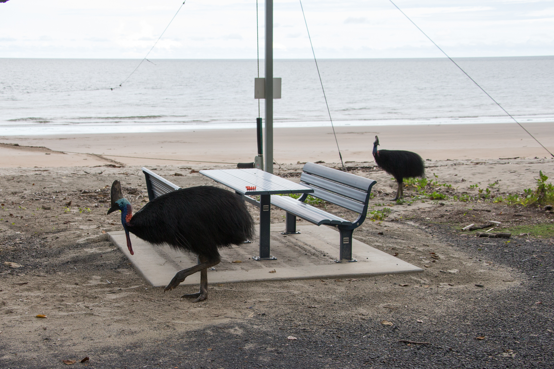
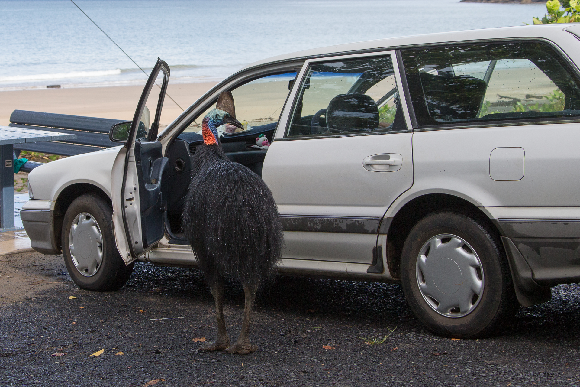
Our next destination was Cairns, which is a good 4 hours drive from Townsville. It was our next homebase for a day trip to Kurunda. We decided to skip Mission Beach, which we thought we would cover on our way back down. The drive north takes you along endless fields of sugar cane. Harvesting season – according to local traffic signs – is from May through December. At least that’s when you have to watch out for hauling trucks. About two thirds up to Cairns, we took a right turn towards the beach. The word was there are occasionally Cassowaries on the beach. – Yeah, I hear you. I thought exactly the same. What a fib.
Etty Beach
The satnav took us to Etty Beach. To our very surprise, the town of Etty Beach was not at the beach at all. It took us rerouting the GPS to the Etty Beach caravan park via a windy road to get us to the beach. Slowly approaching with the car and joking about all of the Cassowary signs – we never saw a Koala on the street, where the signs said Koalas crossing – we didn’t believe our eyes, when we saw them.
Cassowaries at Etty Beach
Cassowaries at Etty Beach
Cassowaries at Etty Beach
Unfortunately, the weather took a sudden turn and I go soaked returning to our car, which was just about hundred meters away. Good time to leave and finally head to Cairns.
Cairns
We stayed in Cairns for two nights and used it as a homebase for a day trip to Kurunda. The city offers a very well developed beach with its own lagoon-sized pools and plenty of BBQing spots, restaurants and other amenities. It’s definitely worth a stroll in the evening. Close to the beach a colony of flying foxes made some large trees their home. The noise and smell is quite particular, but nevertheless worth experiencing.
Kurunda
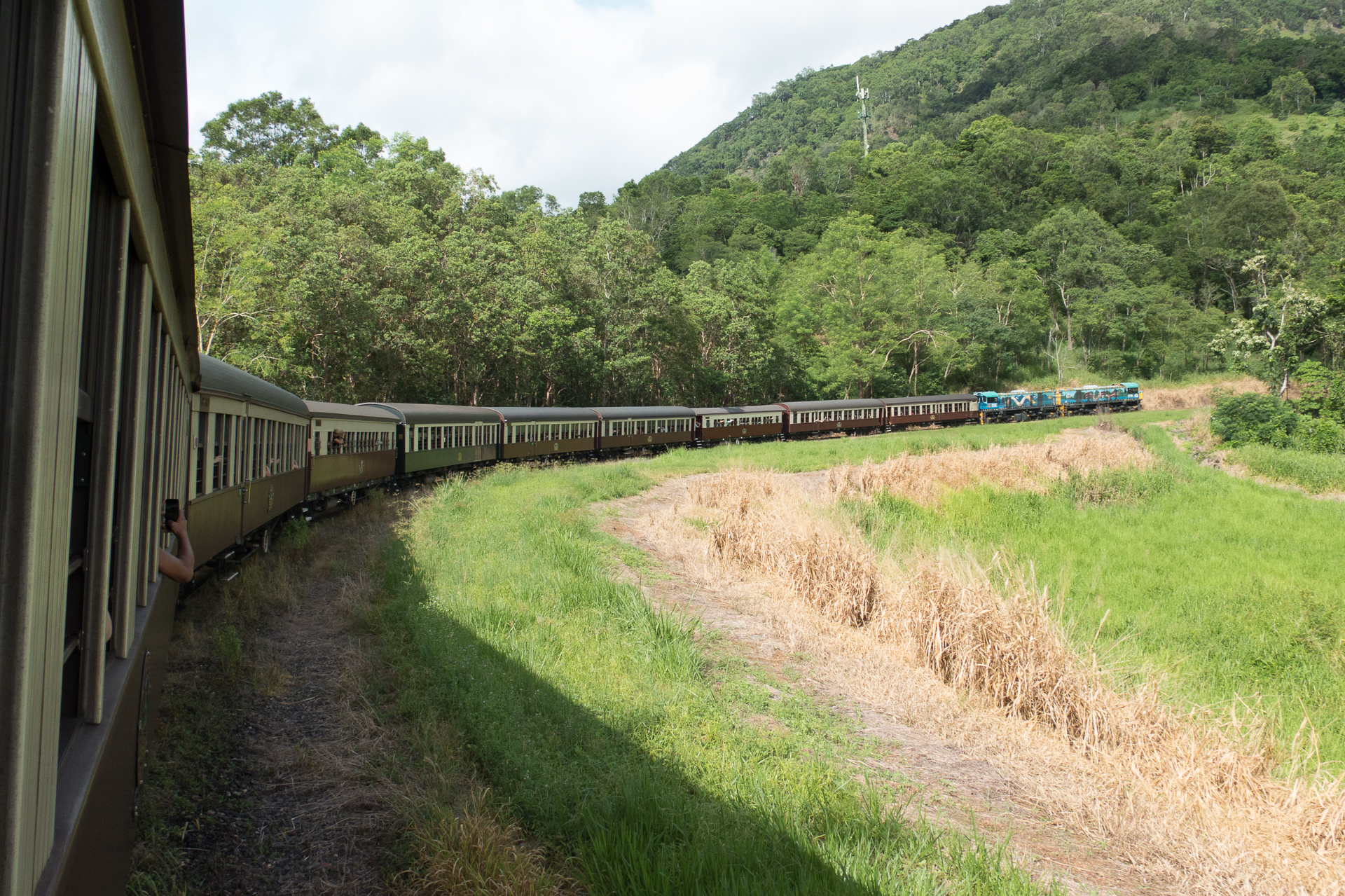
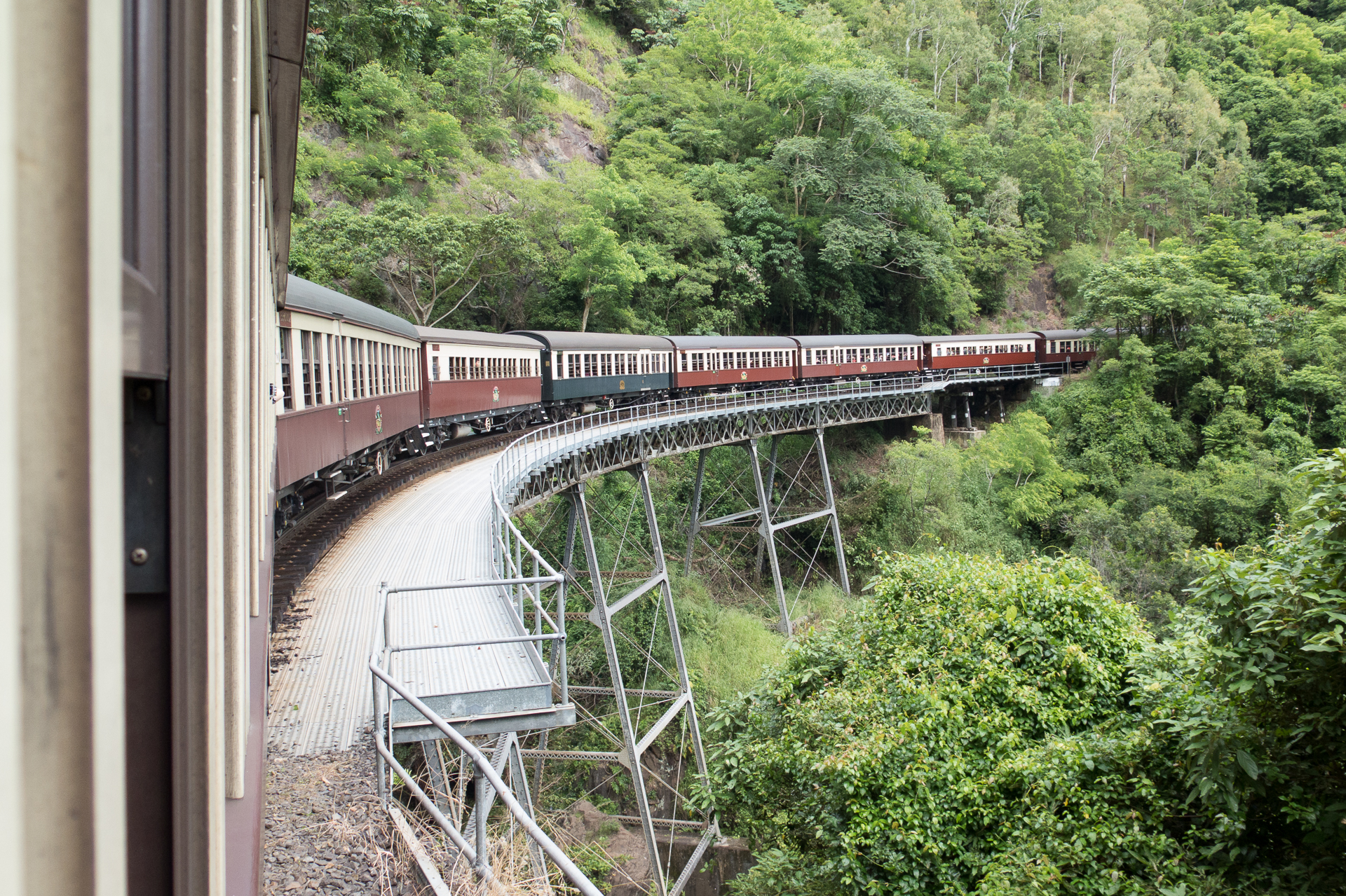
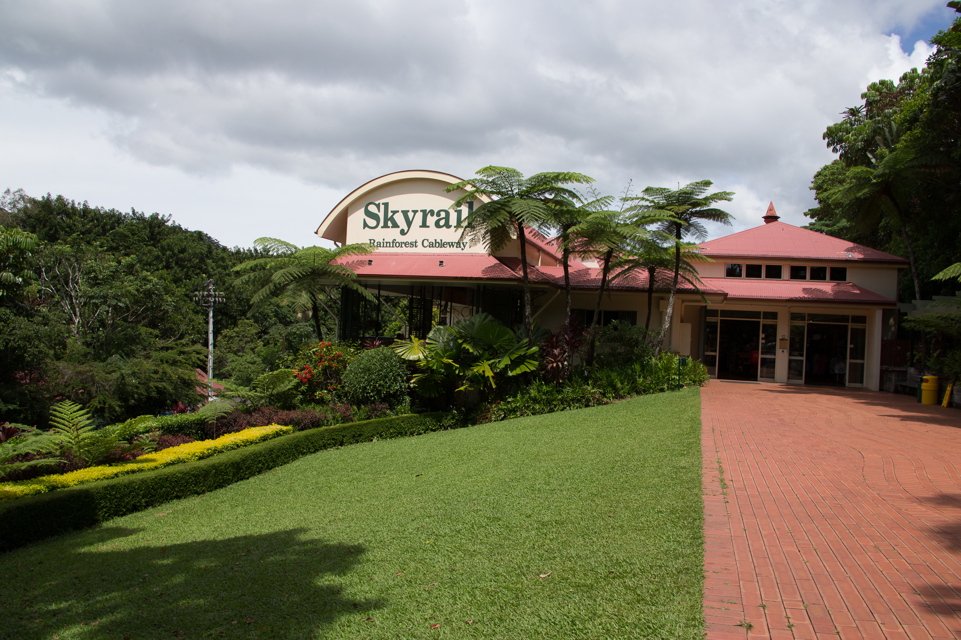
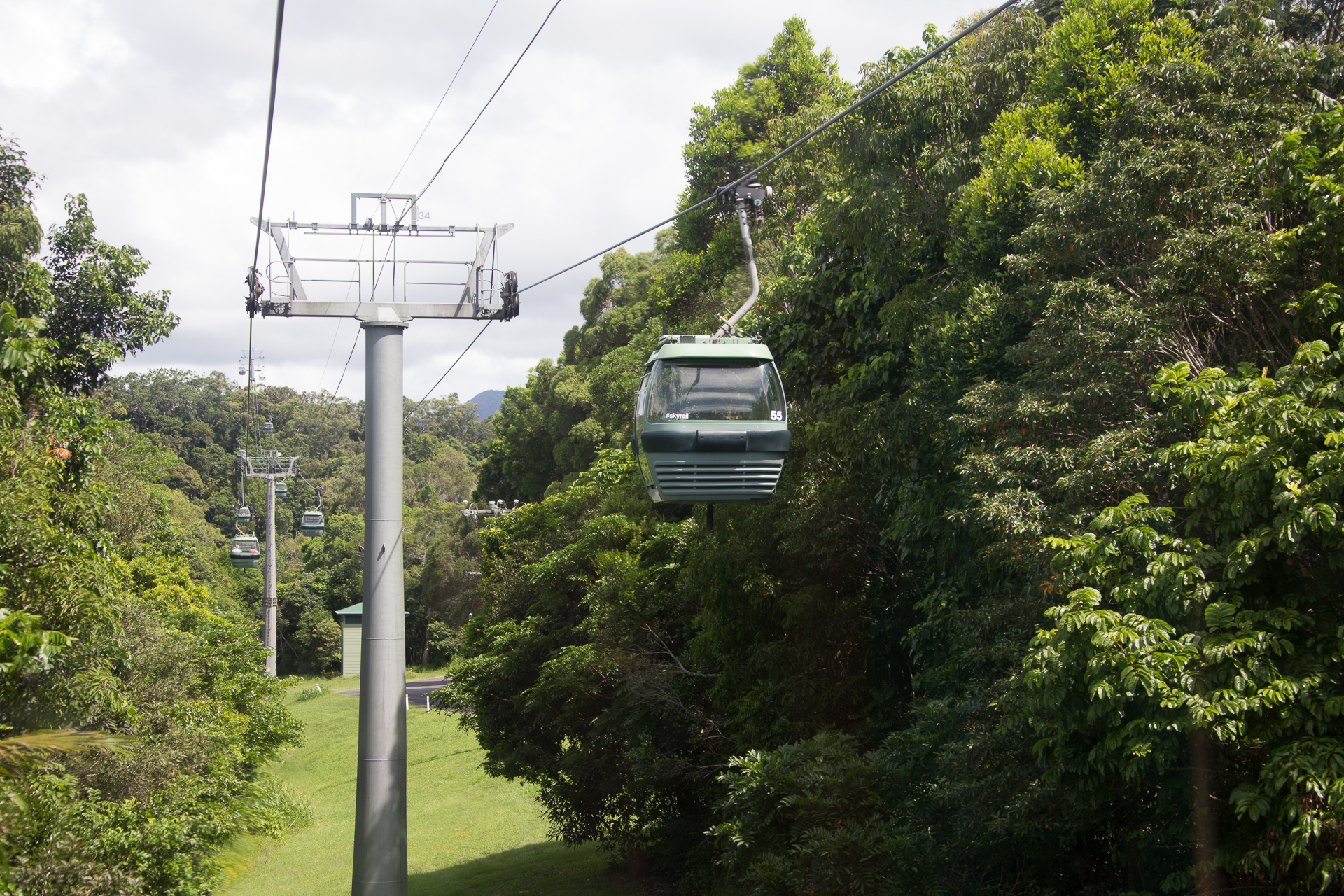
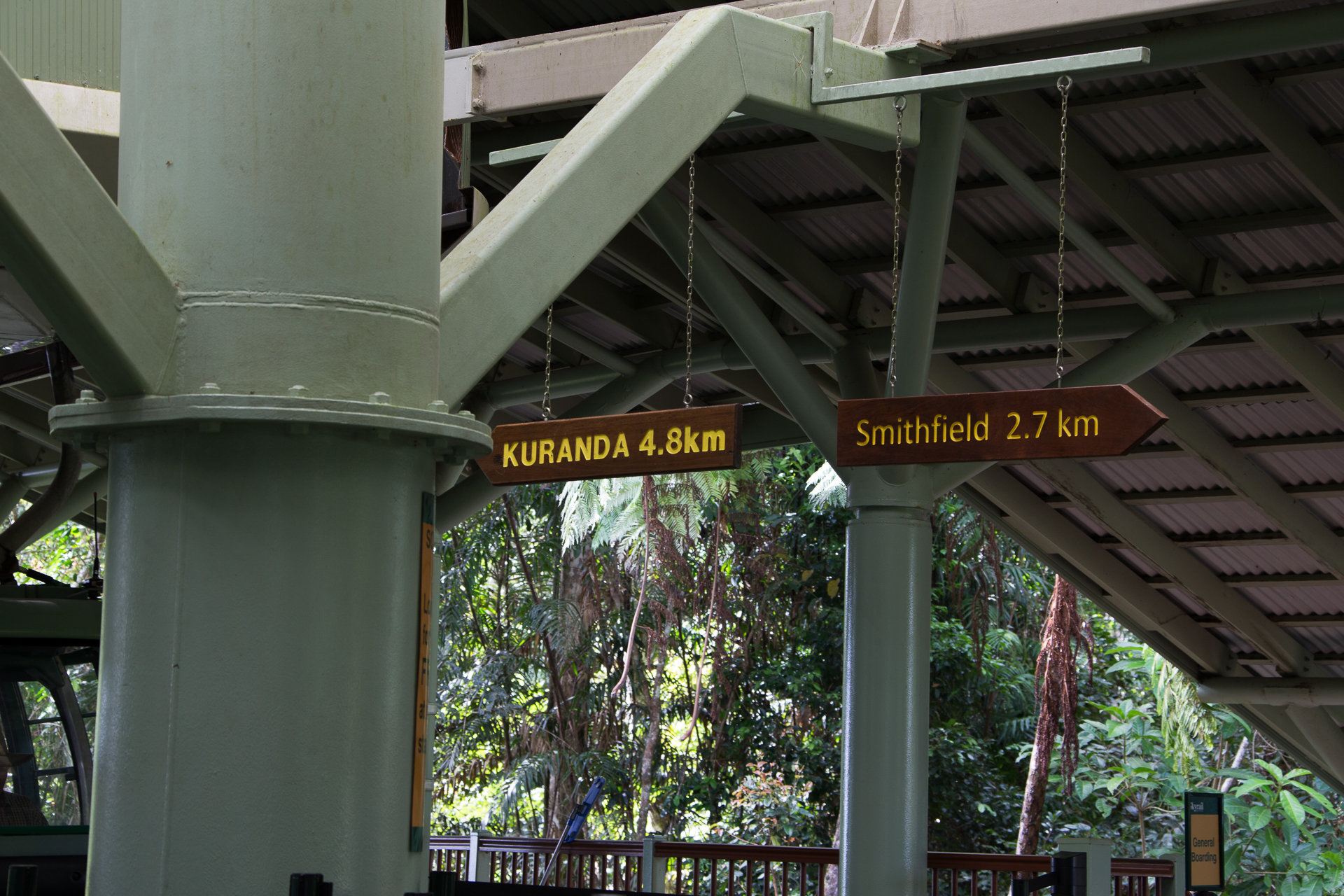
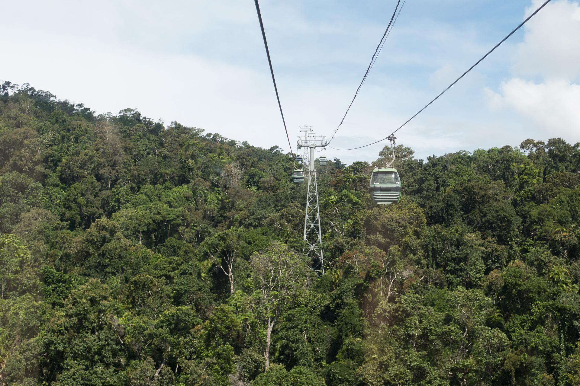
The next day we got up at 5:30am to make the 8:30am departure of the historic Kurunda Scenic Railway. Our original plan to take the train up to Kurunda, the Skyrail down and up again, and then finally the train down back again to Cairns, wasn’t feasible. Hence we opted for a package tour: We took the train up to Kurunda, strolled the town for a few hours, then rode the Skyrail down to Smithfield Terminal to take a bus back to Cairns.
Kurunda Scenic Railway
Kurunda Scenic Railway
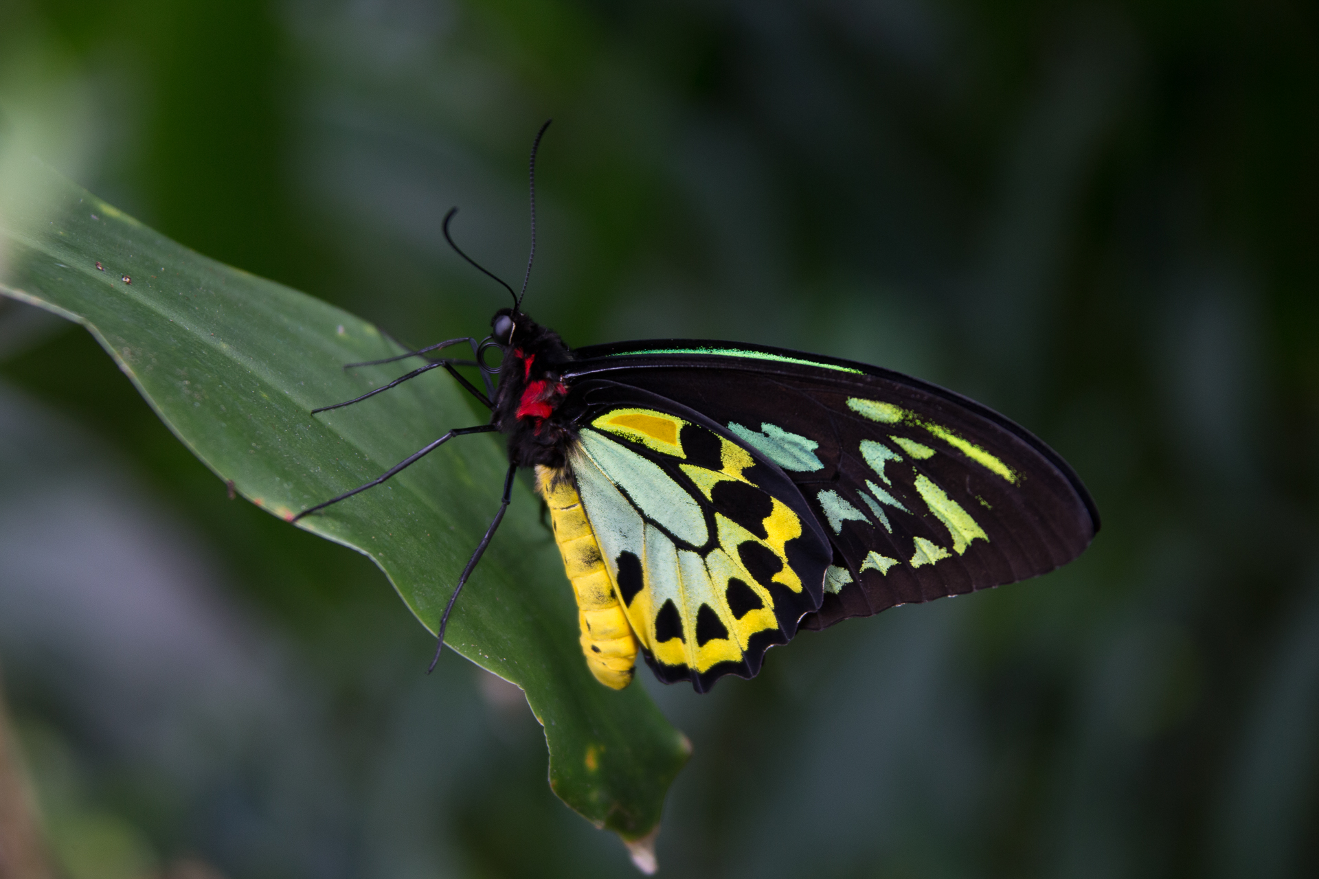
Butterfly farm in Kurunda
Golden orb spider
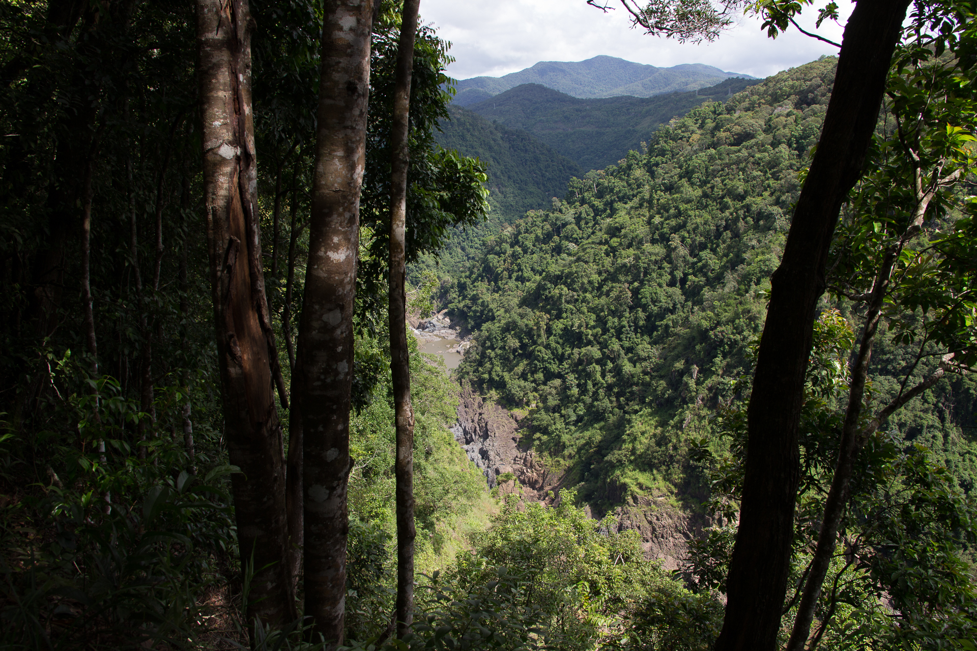
Kurunda Skyrail
Kurunda Skyrail
Kurunda Skyrail
Byron River viewed from Skyrail Platform
Kurunda Skyrail
Kurunda offers a lot to see for the few hours you got on that round trip. We decided for a stroll on the town’s Coondoo street, explore one of the photo galleries, visit the butterfly farm and then grab late lunch at one of the many tiny eateries in the Kurunda Rainforest Market.
We left Mount Isa towards Townsville early at dawn. Driving 900km+ with a seven month old child takes a long time, particularly if you are not allowed to go faster than 100km/h and speeding fines are draconian. We planned our first feeding stop in Cloncurry. This time our little one decided differently however. She strongly demanded food in the middle of nowhere. So we pulled to a parking bay and satisfied her demand.
Our next stop was Hughenden around lunch time. It was so hot on that day, we had to seek some airconditioned shelter. I only recall the roadhouse where we we stopped for fish and chips. Not very memorable food, but it had cool air.
A few dozen kilometers, the landscape and particularly the color of the soil changed significantly as we cut through the White Mountains National Park.
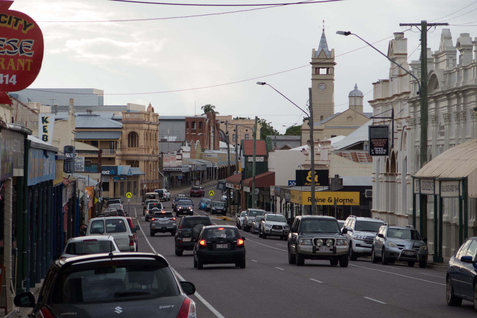
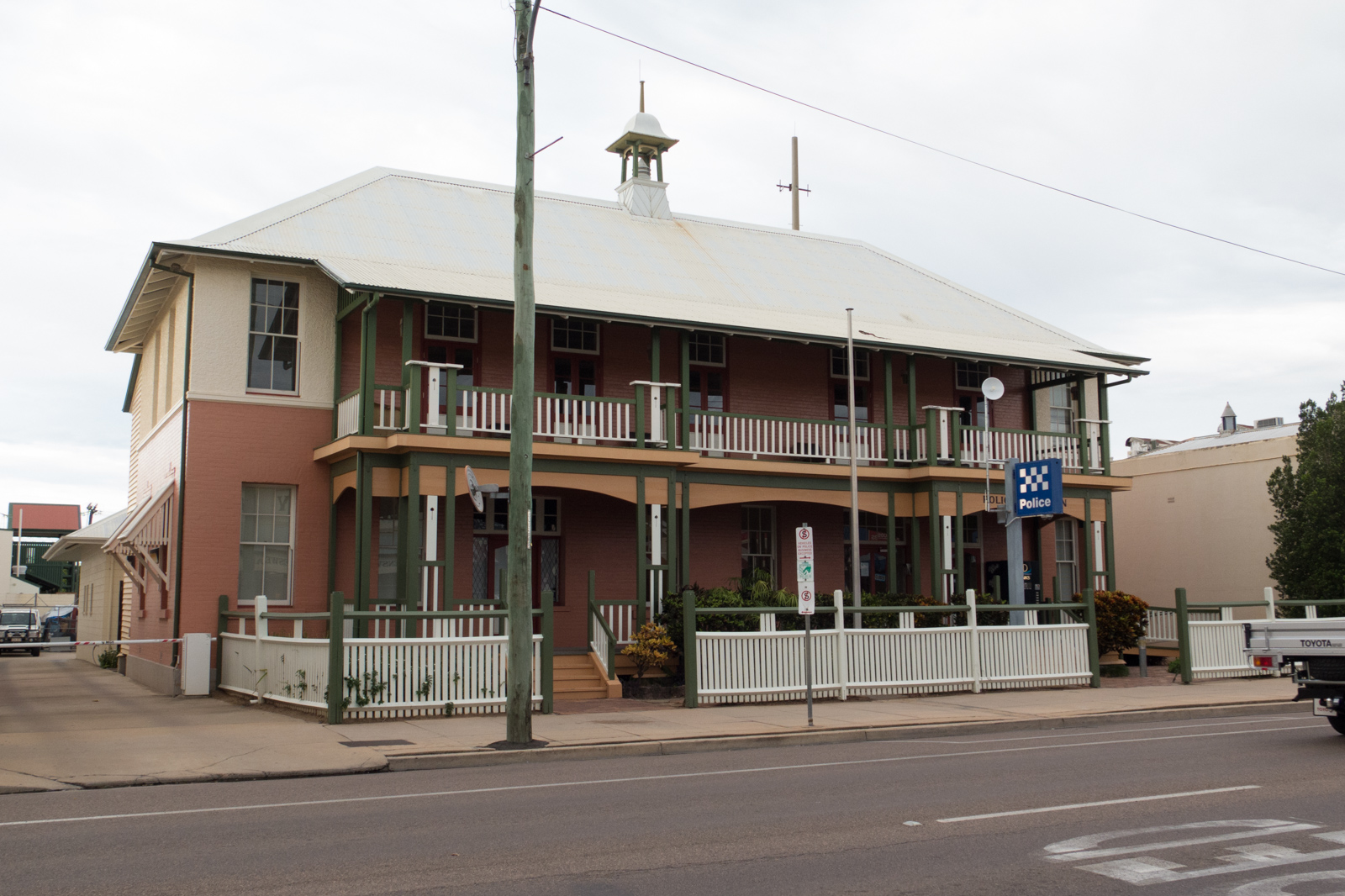
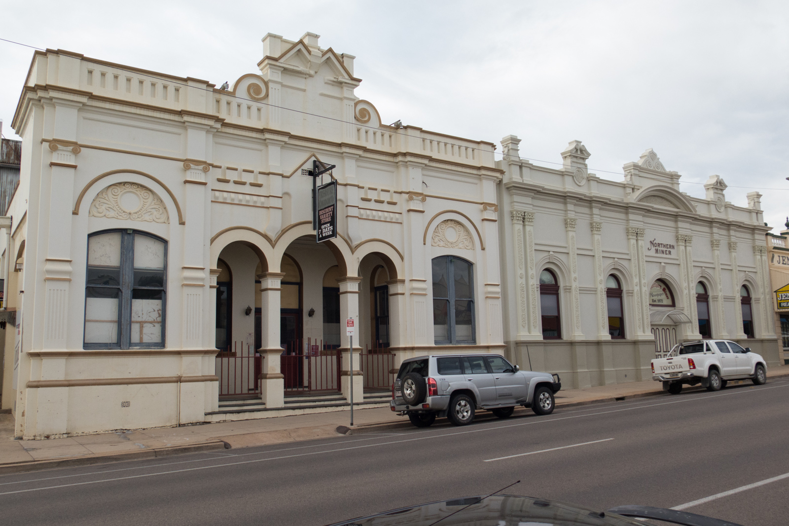
Charters Towers
As an old mining town Charters Towers is the first larger city on your way from the Outback to Townsville. A number of old buildings have survived the growth of the town and form a city center worth stopping by – especially when you have been traveling the outback for some time. Perfect for feeding our little one again, have a bit of play time and stretch our legs.
Charters Towers
Charters Towers
Charters Towers
We continued our journey early evening and dusk set in. We arrived at the outskirts of Townsville around 8pm. Gladly we checked into our accommodation and decided to have a very easy next day. Our sprint from Alice Springs to Townsville has taken its toll. Everyone in the family needed a rest.
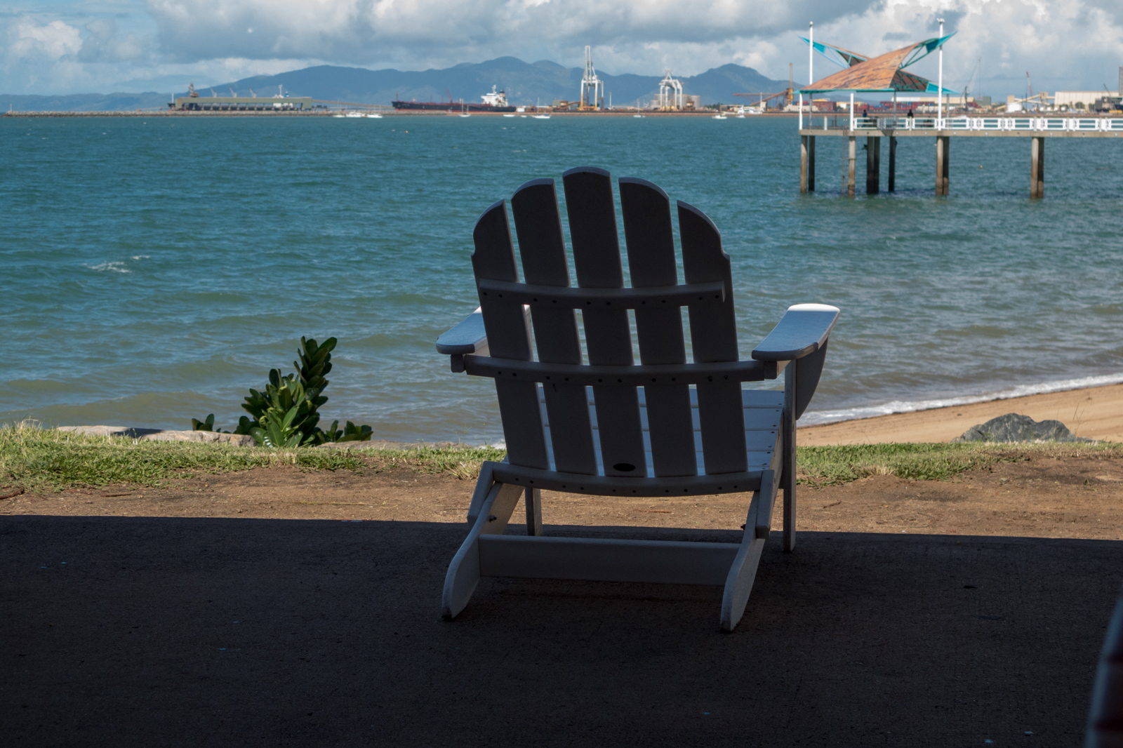
Townsville
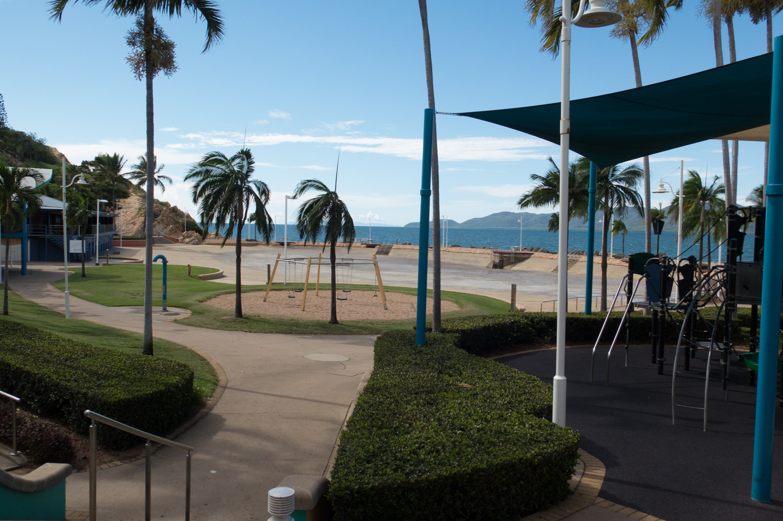
The look in the mirror the next day confirmed a shave wouldn’t be enough today. I needed to find a hairdresser. After a short walk in the morning, I had my appointment for the afternoon. We spent the day replenishing our supplies, strolling along ‘The Strand’ and dozing in the pool.
The Strand of Townsville
Tidal Pool in Townsville
The next day we visited ‘Reef HQ’, the local aquarium. It was amusing to see how our little one observed and interacted with the larger fish. Particularly a few large groupers seemed to interest and amuse her.
Magnetic Island is one of the main attractions of Townsville. However, we decided to skip it. We felt we had seen enough rock wallabies, beaches and sand so far – and Fraser Island was also still ahead of us.
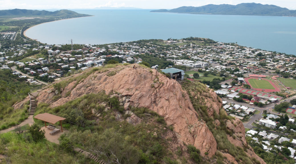
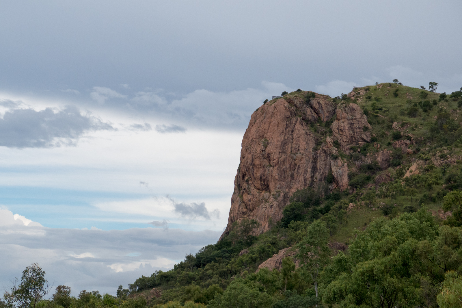
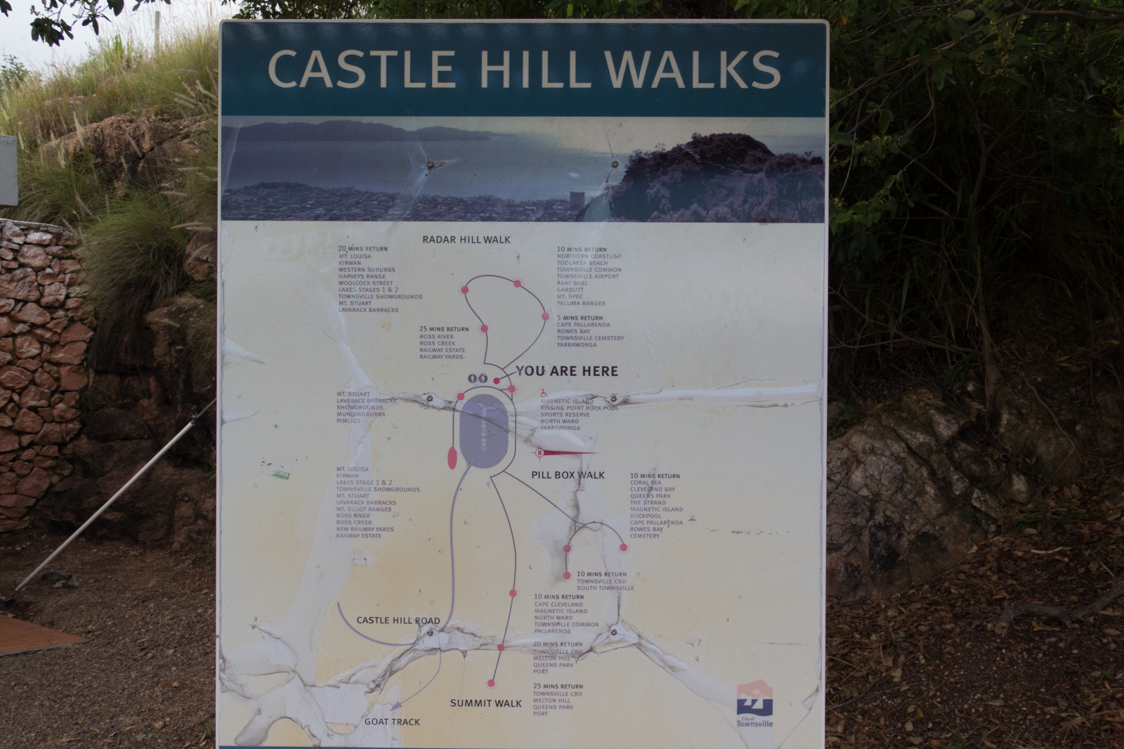
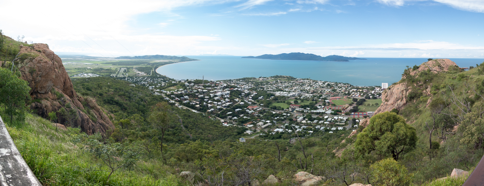
Hence the next day, we were going up Castle Hill. The exceptional views have just been limited by occasional rain showers in the distance. From top of the hill you get stunning views of Townsville and its surroundings.
Castle Hill
Castle Hill Walks
Townsville viewed from Castle Hill
The next day, we left Townville northbound to Cairns.
We were about to leave Northern Territory this day. We have been warned by friends that the drive from Tennant Creek to Mount Isa on Barkly Highway will be one of the most boring parts of our journey. Yes it was in some aspects – but on the other hand it wasn’t.
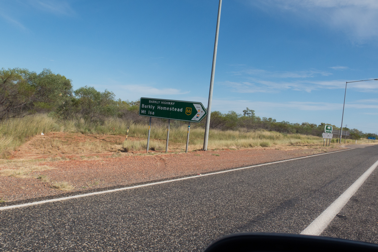
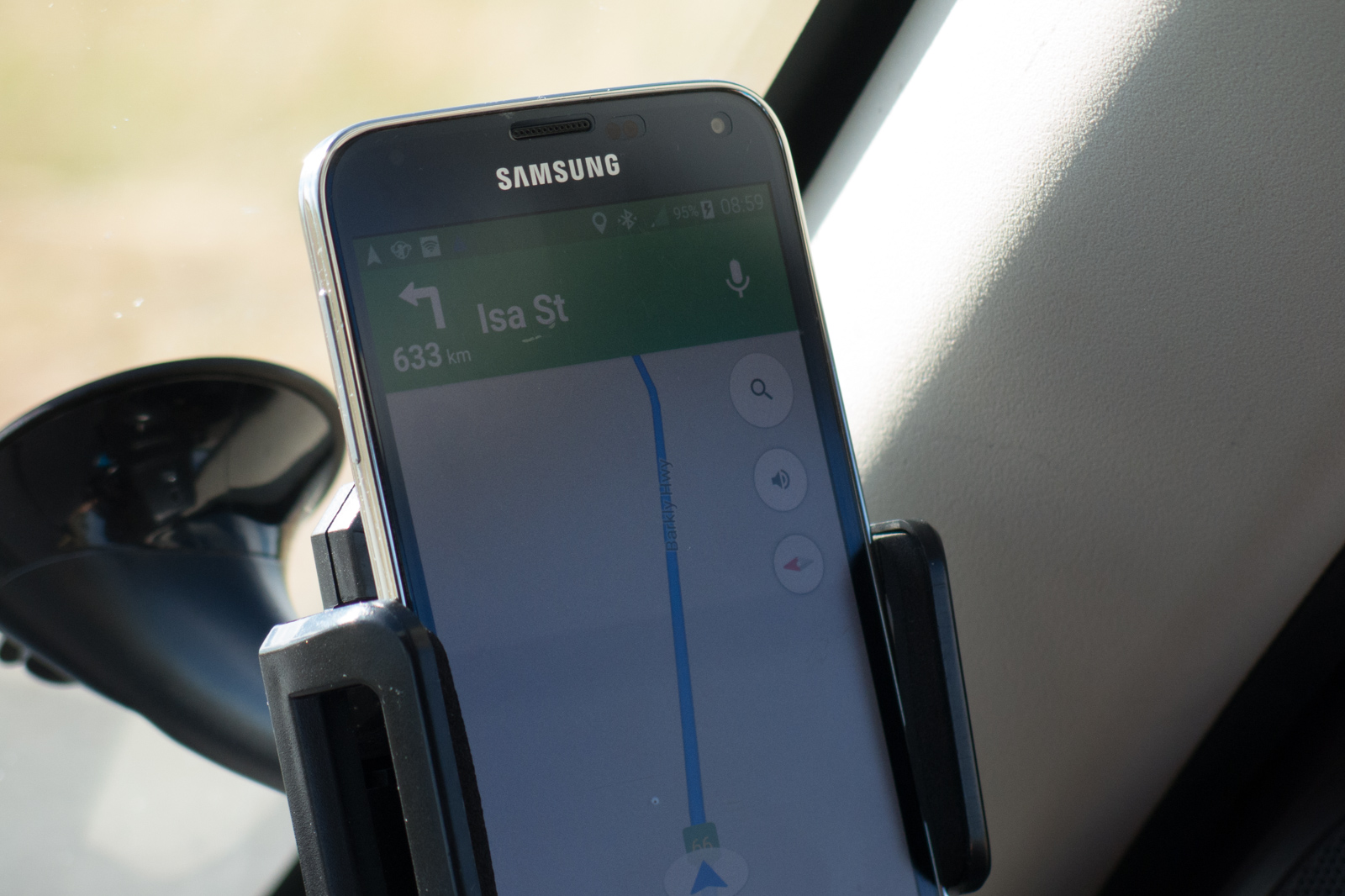
After we headed north from Tennant Creek and turned east onto the Barkly highway, the SatNav voice said: “Turn left in 634km.” which silenced it for the rest of the day.
Threeways junction
SatNav directions to Mt. Isa
Barkly Highway
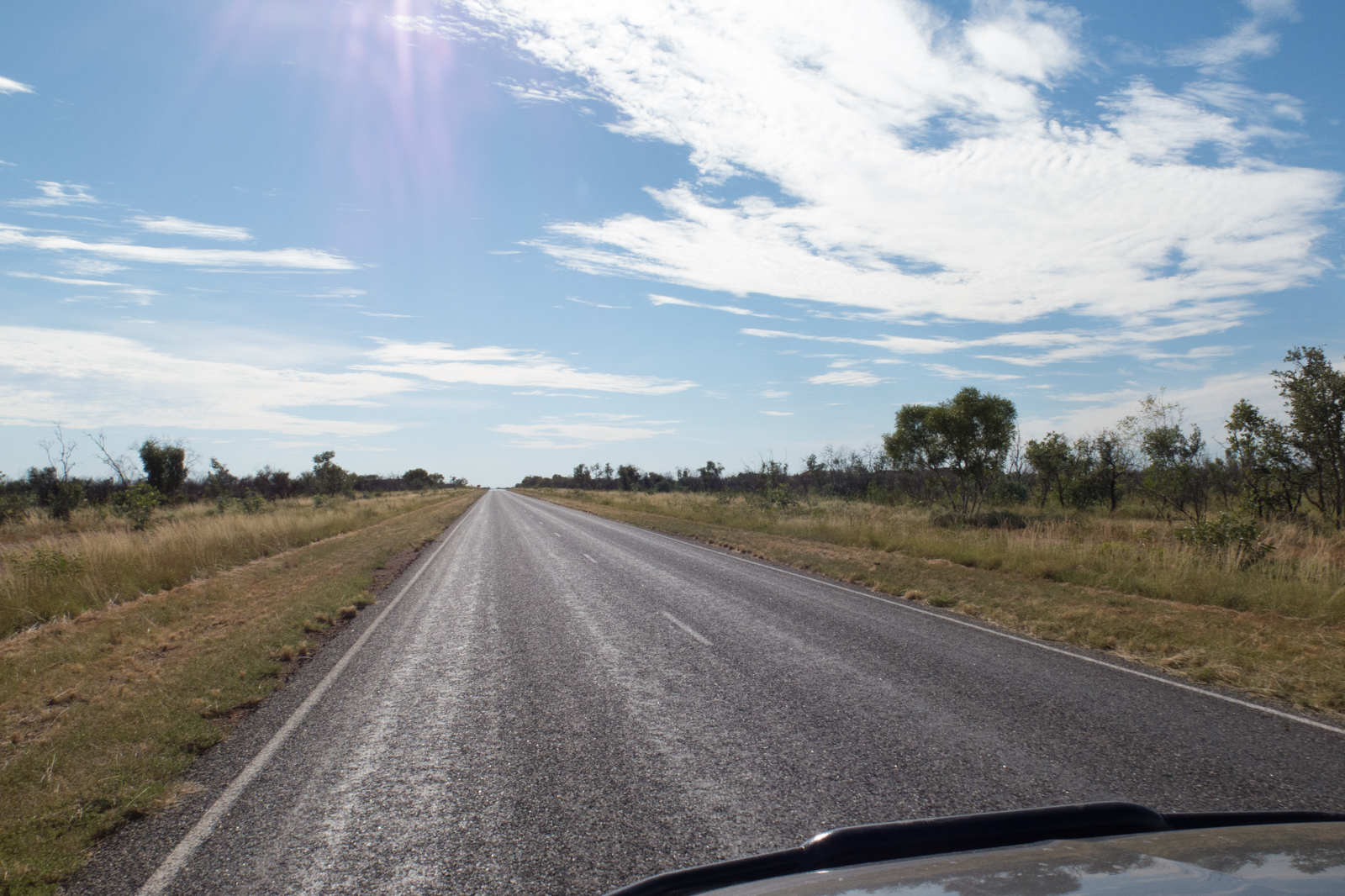
The drive was rather uneventful apart from some 50-meters-plus long road trains, which passed every or every other hour. During the whole drive, we saw about three to four cars traveling in our direction, and maybe twenty in total going the opposite way.
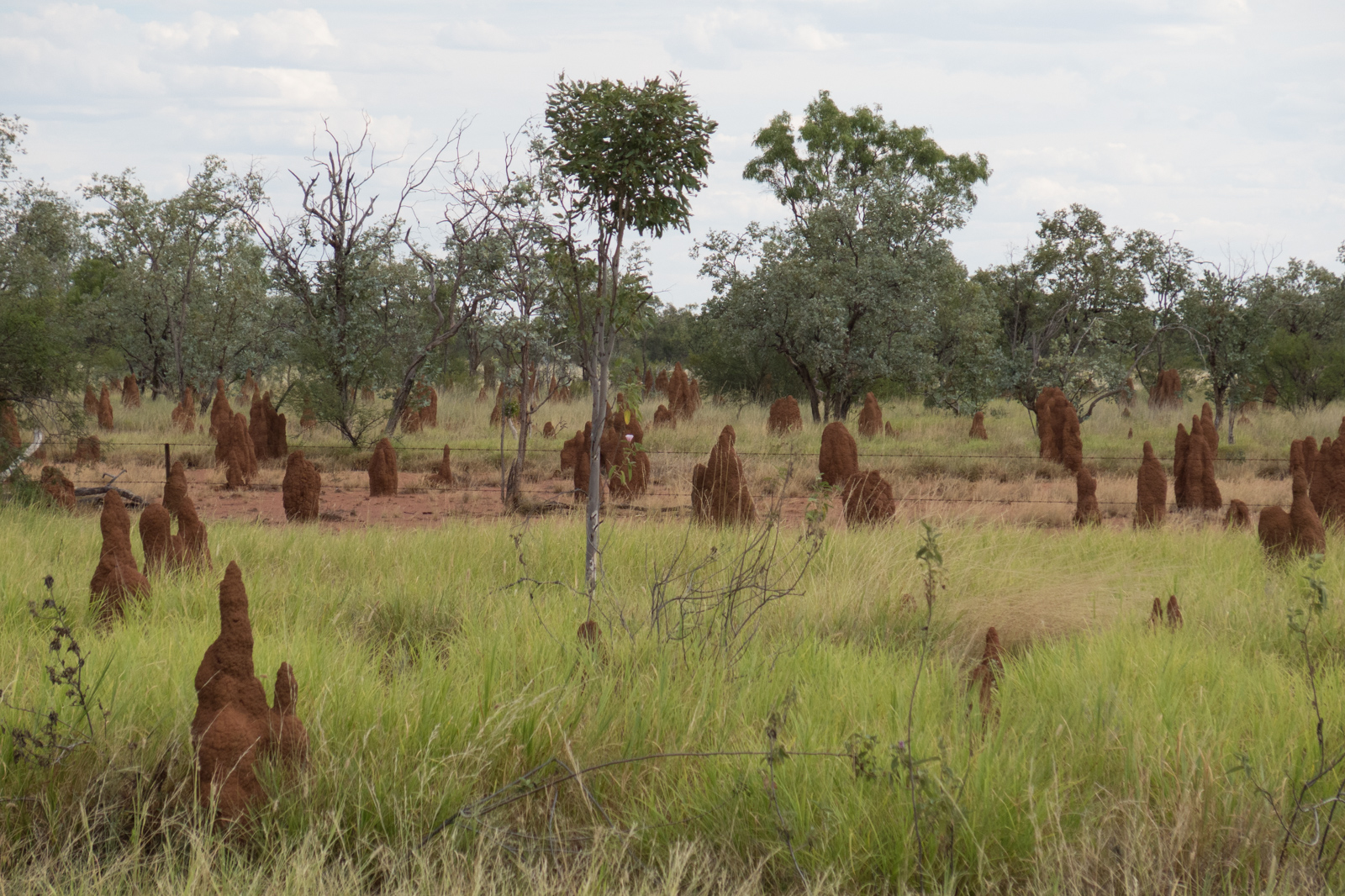
You could start getting bored if there weren’t ever changing landscapes from flat lands to rolling hills – or sudden encounters with a perentie (huge lizard) sitting in the middle of your lane and not moving a single inch even when you pass it. Another eye-catcher are termite mounds. It’s not a few, it’s not a few hundreds, it’s endless. You drive for miles and there is one termite mega-city following the other one.
Termite mounds along Barkly Highway
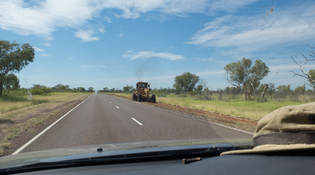
Since we were traveling with a rented car, we had to do some prechecks. Whether we would be allowed to travel this area – specifically the part between Commonweal and Mt. Isa. It seems this time FTI, our rental agent in Germany, had got their documentation wrong, because Europcar’s T&Cs said “no travel northwest of Mt. Isa on unsealed roads”. Well, the Barkly Highway is perfectly sealed and in very good condition. Much better than some of the other highways we traveled during our three months here like the A1 on the east coast, which got ‘rough surface’ in many areas. So keep peace of mind. This highway is perfectly fine to travel.
Mount Isa
Arriving in Mount Isa, which is a large mining town, we checked into our accommodation. We were surprised by the splendid view of our room).
View from our room in Mt. Isa
It was the first above-ground accommodation I ever stayed in, which had no windows at all. Well, it was for a short night sleep anyway. Tomorrow, we’ll be on the longest drive of our journey – more than 900km on a single day in a country with a speed limit of 100km/h.
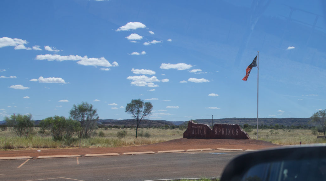
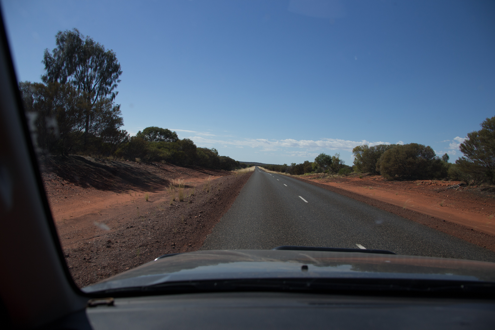
This day, we were departing from Alice Springs to Tennant Creek with a stop over at the Devils Marbles. We chose Tennant Creek as our next overnight stay, because its close to Threeways (Warumungu), but provides more choice for accommodation. In Threeways the Barkly Highway branches off the north-south bound Stuart Highway and connects the region to the east coast. In case you have heard (old) stories, that the Barkly Highway is a dirt road and dangerous to travel beyond Commonweal: It is not. It’s paved all the way to Mount Isa and onwards and perfectly safe to travel even with a cosy 2WD sedan.
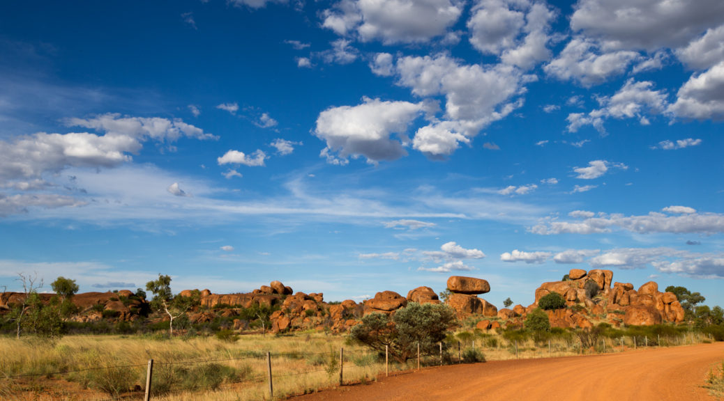
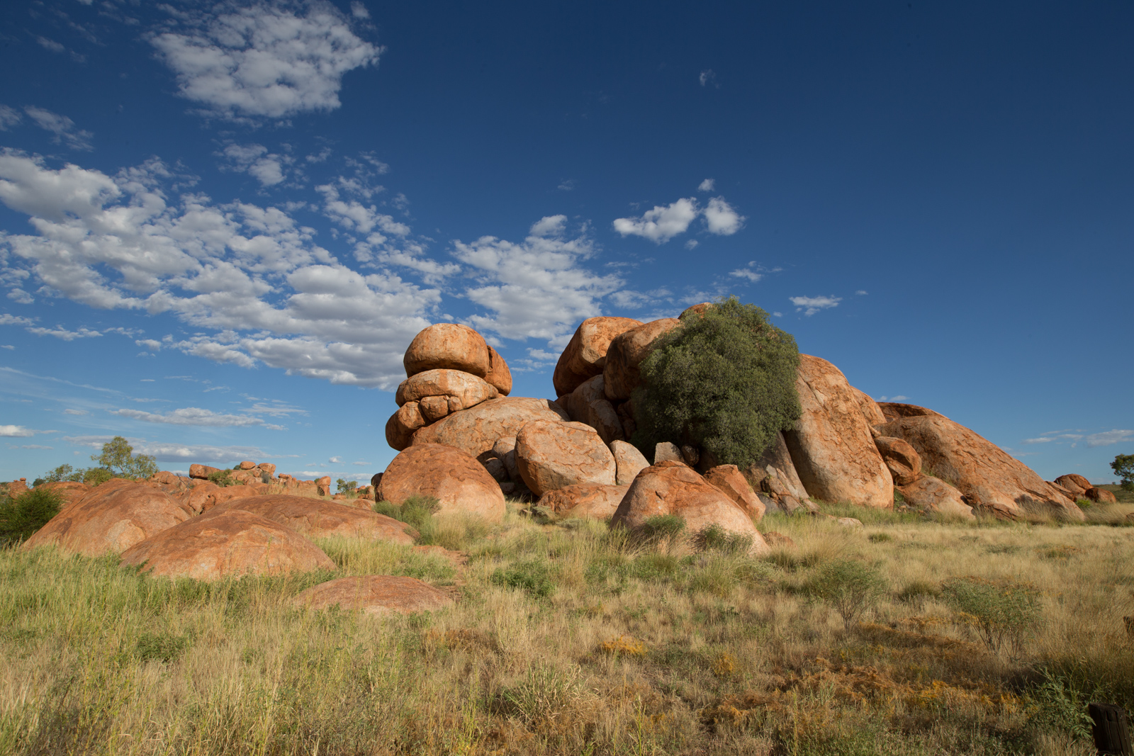
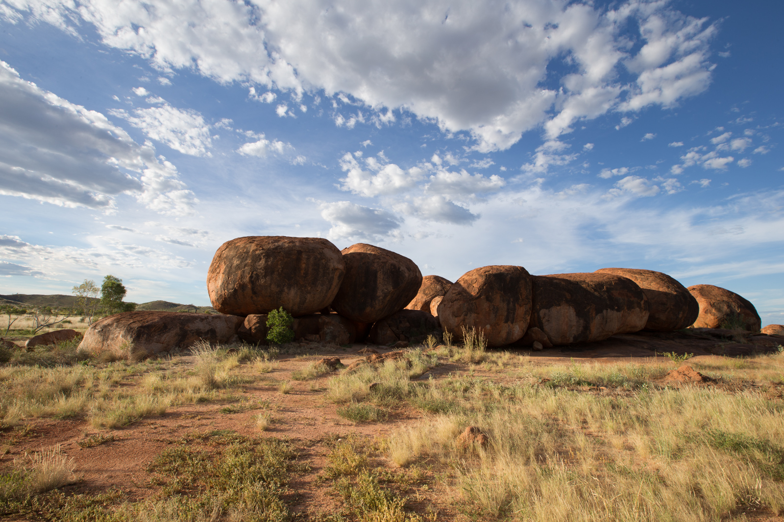
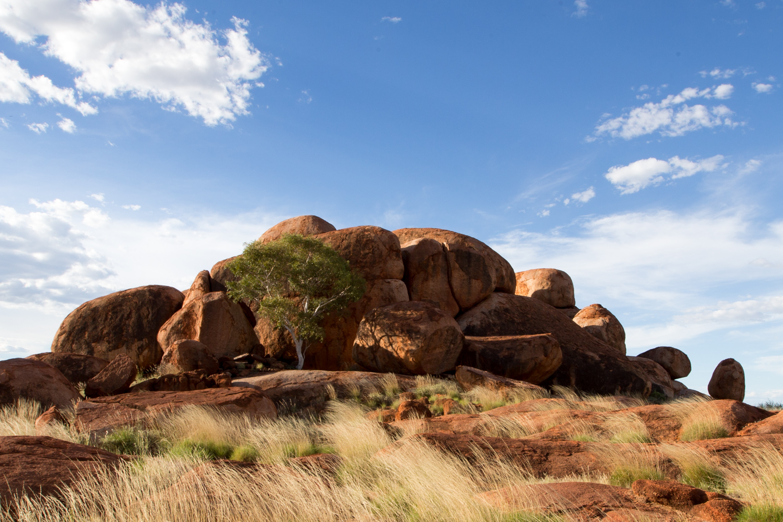
On our more than 500km route to Tennant Creek, besides a few old telegraph stations, there was just one major attraction – Devils Marbles. They are about 400km north of Alice and therefore we arrived late afternoon. A perfect time for taking pictures as the sun was going down and changing color from bright white of the day to evening’s orange and red tones.
Devils Marbles
Devils Marbles
Devils Marbles
I am not sure though if Devils Marbles is the appropriate name to describe a site like this though. Gods Marvels might be it.
In case you are using Google Maps for travel planning – choose the Devils Marbles Conservation Centre, not other similar entries. However, once you are on the road, it’s really hard to miss. It’s well signed and quite obvious to see from the highway.
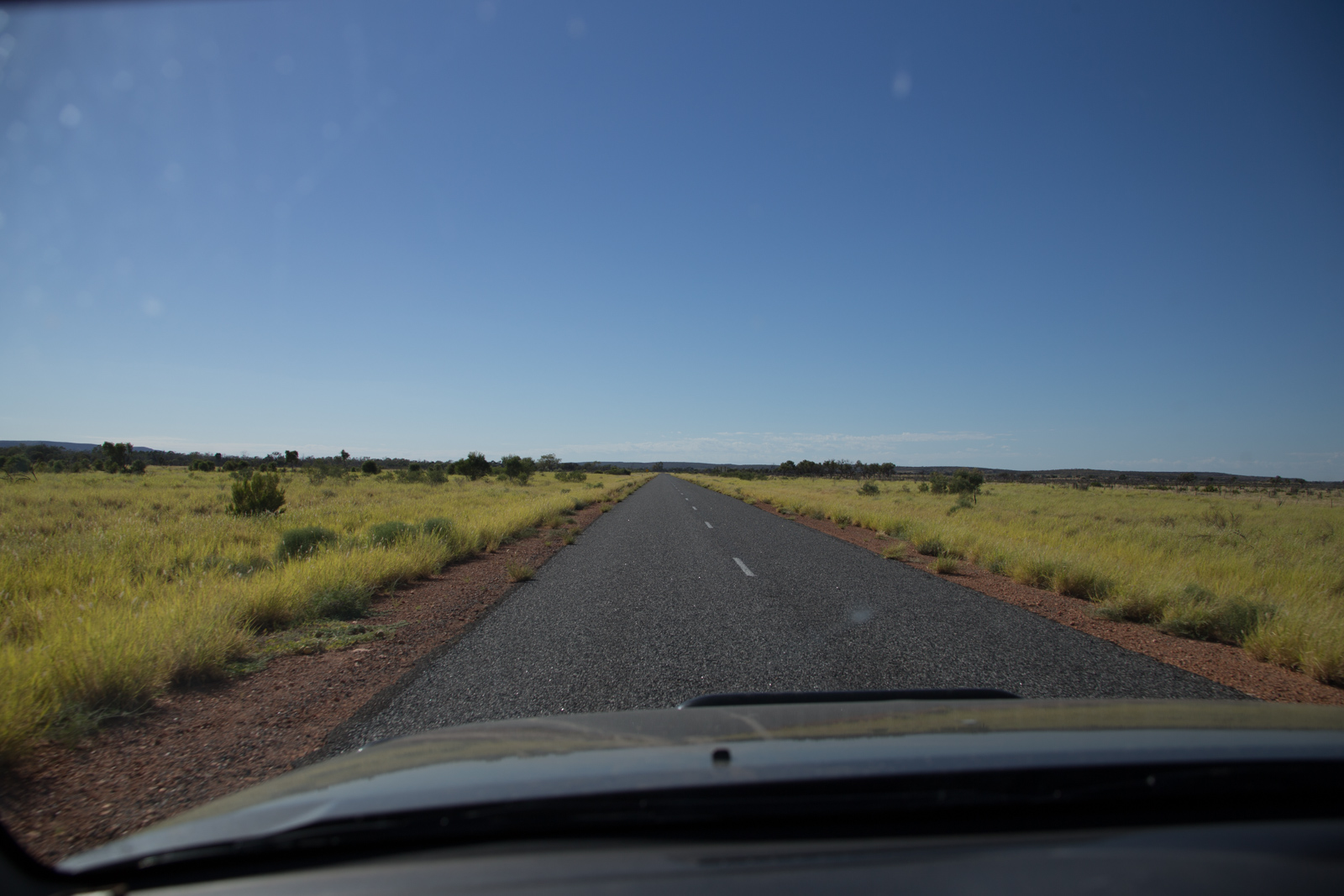
It took us a day driving the almost 500 kilometers from Kings Canyon to Alice Springs. Although the landscape and vegetation in general remains more or less the same, we still found it impressive to look at the different nuances. Groves of desert oaks make room for paddocks with grazing cattle. The red soils is universal. It comes in many different shades though from the deep orange-brownish red of Ayers Rock to light ochre tones.
Luritja Road
Luritja Road
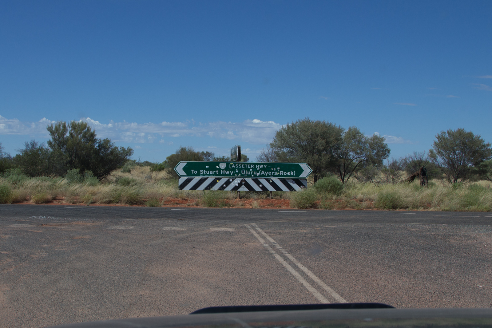
Lassiter Highway Junction
We were very lucky when we traveled the area. Just a few weeks before, heavy rain watered the arid land. We saw more green and blossoms than all the years before, locals told us.
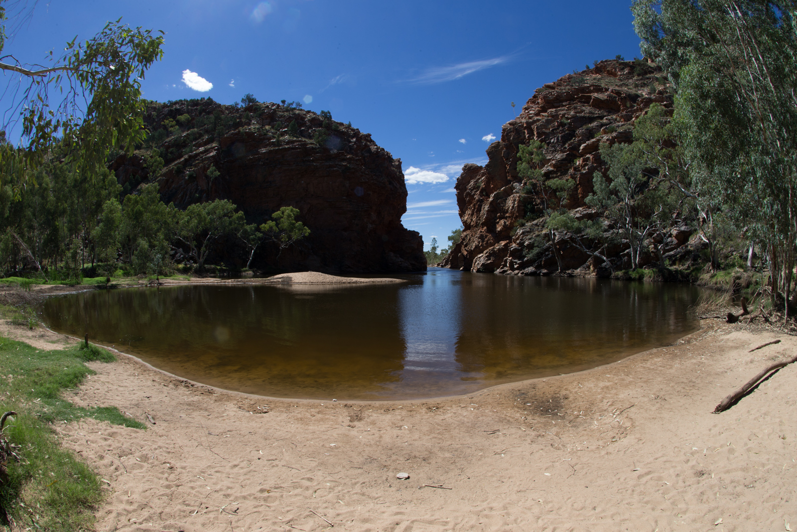
MacDonnell Ranges
The next day, we explored the area west of Alice Springs. The MacDonnell National Park provides some spectacular sights. The top ones on our list were Ormiston Gorge, Ochre Pits, Ellery Creek Big Hole and Simpsons Gap. We skipped Standley Chasm because we felt that we could save the 12.00 AUD per adult entry fee having seen all the other great gorges and gaps in the MacDonnell Ranges. A ‘gap’ being a cut-through the mountain range created by millions of years of water flow.
Ormiston Gorge
Ochre Pits
Ellery Creek Big Hole
Simpsons Gap
At the end of the day when we arrived back in Alice Springs, we recapped the day and agreed the spots and walks here had been much more impressive than the creek walk in Kings Canyon.
A Secret Place
In the motel, where we stayed, there was an impressive picture of a rock or small mountain range right above the bed. It had caught my eye on day one, so I did some research including looking at satellite pictures on Maps and found the place. It was not too far from Alice Springs, but recommended for 4WD only. That sounded exactly like one of the places we wanted to explore. When we arrived there and the sun started to set, we stood there in marvel. So were the gazillion of flies there, which met some of the very few tourists at that spot and made us wear our fly-nets again. Here is what we aww’ed at:
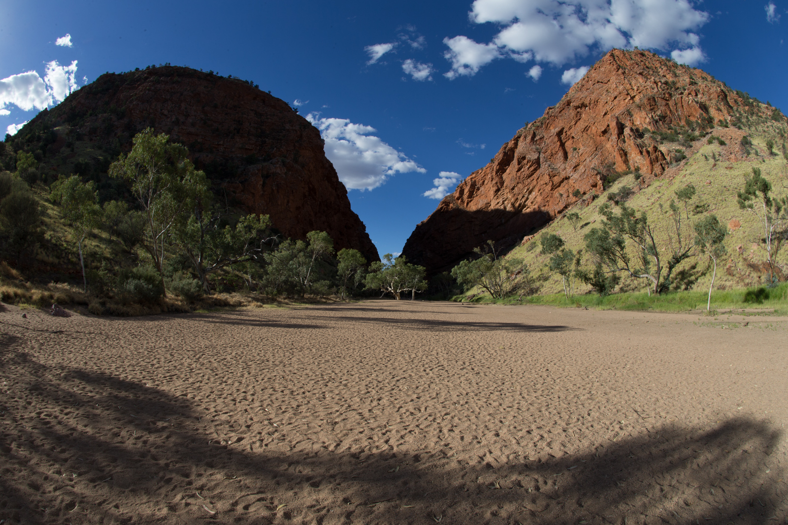
You might think Kings Canyon has been named in honor of some royalty. However, it has been Ernest Giles, one of the great Australian explorers, who named it after his friend Fielder King.
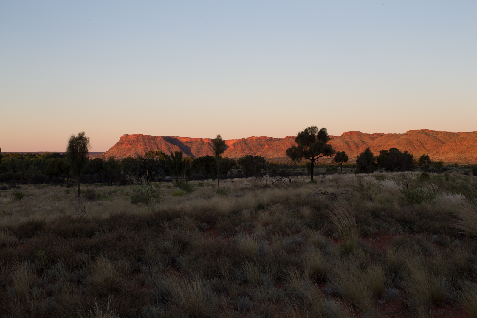
It took us a few hours drive on tarmac to get us from Ayers Rock to Kings Canyon. The resort there has a defacto monopoly and charges accordingly. Late afternoon we were strolling to the sunset viewing area and saw the rim of Kings Canyon light up dark red as the sun went down.
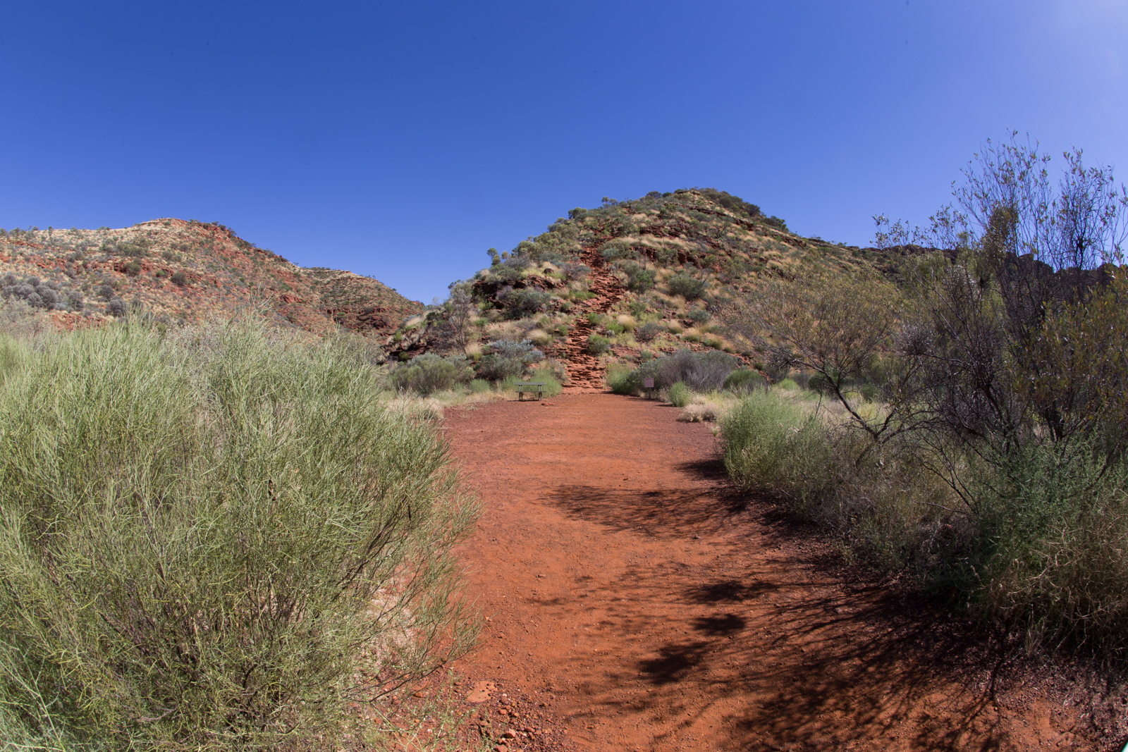
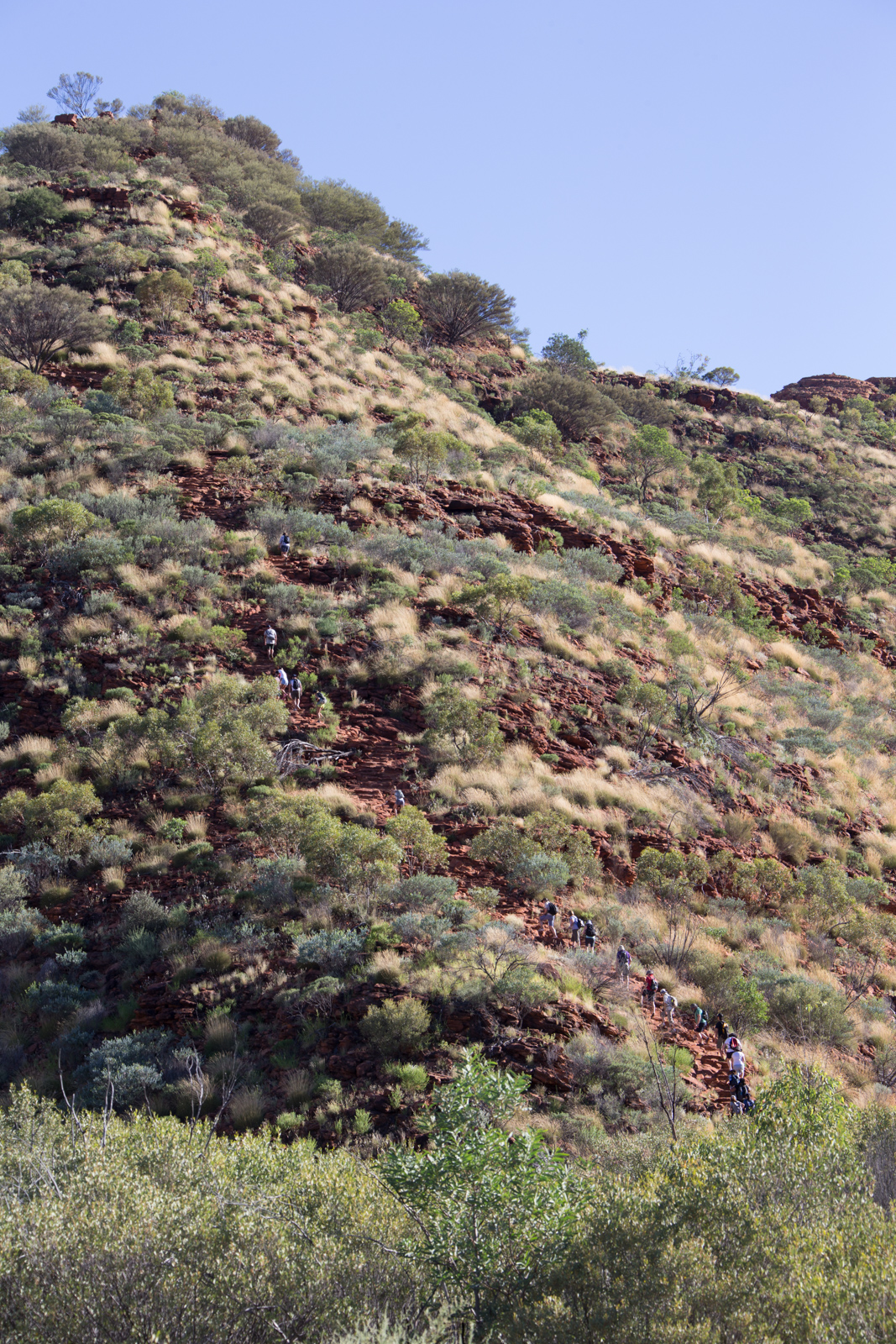
The next day, we had planned to do the Kings Creek walk. It is not the famous rim walk, which takes you up and around Kings Canyon for a few hours. On the picture in the middle, you can see the start of the rim walk, which is a fenced off and supposedly CCTV’ed area, because you must not start the walk after 9am in the morning under hot weather conditions. This walk is not suitable for folks carrying a little toddler around. On the photo on the right, you can see the ‘ant trail’ of tourists and hikers ascending towards the rim.
Kings Canyon sunset viewing area
Kings Canyon Rim Walk
Kings Canyon Rim Walk
Kings Creek walk
The Kings Creek walk on the other hand follows the valley of the creek until the walk hits a fenced area about two thirds into the valley. The rest of the valley is closed for public as it is considered a sacred site by the local Aborigines. This walk is suitable for families even with small kids and is open throughout the day.
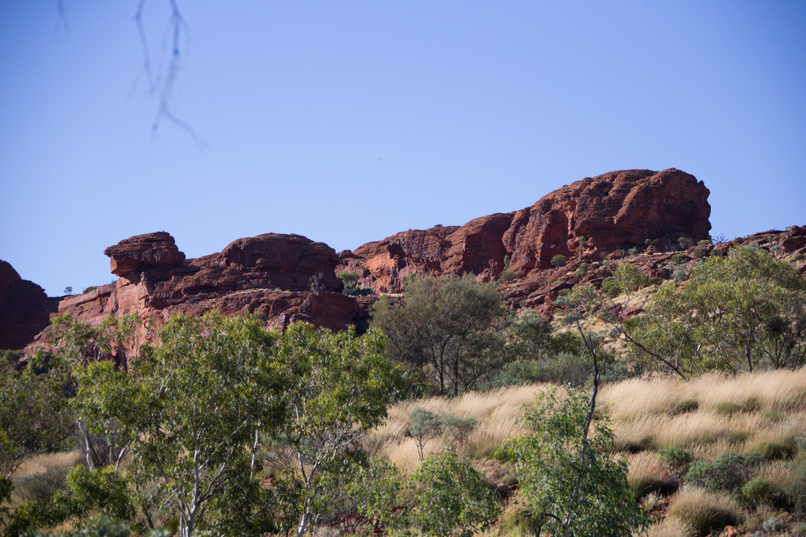
Kings Canyon
Kings Canyon
End of Kings Creek walk
To tell the truth, we have been very disappointed with Kings Canyon. It’s probably due the fact that we couldn’t do the rim walk with our little one. The creek walk is a nice walk, but it cannot cope with other spectacular sites we have seen in Australia and elsewhere. Since the last and – presumably – best part of the valley has been fenced off, which we didn’t know, our disappointment has been even more profound.
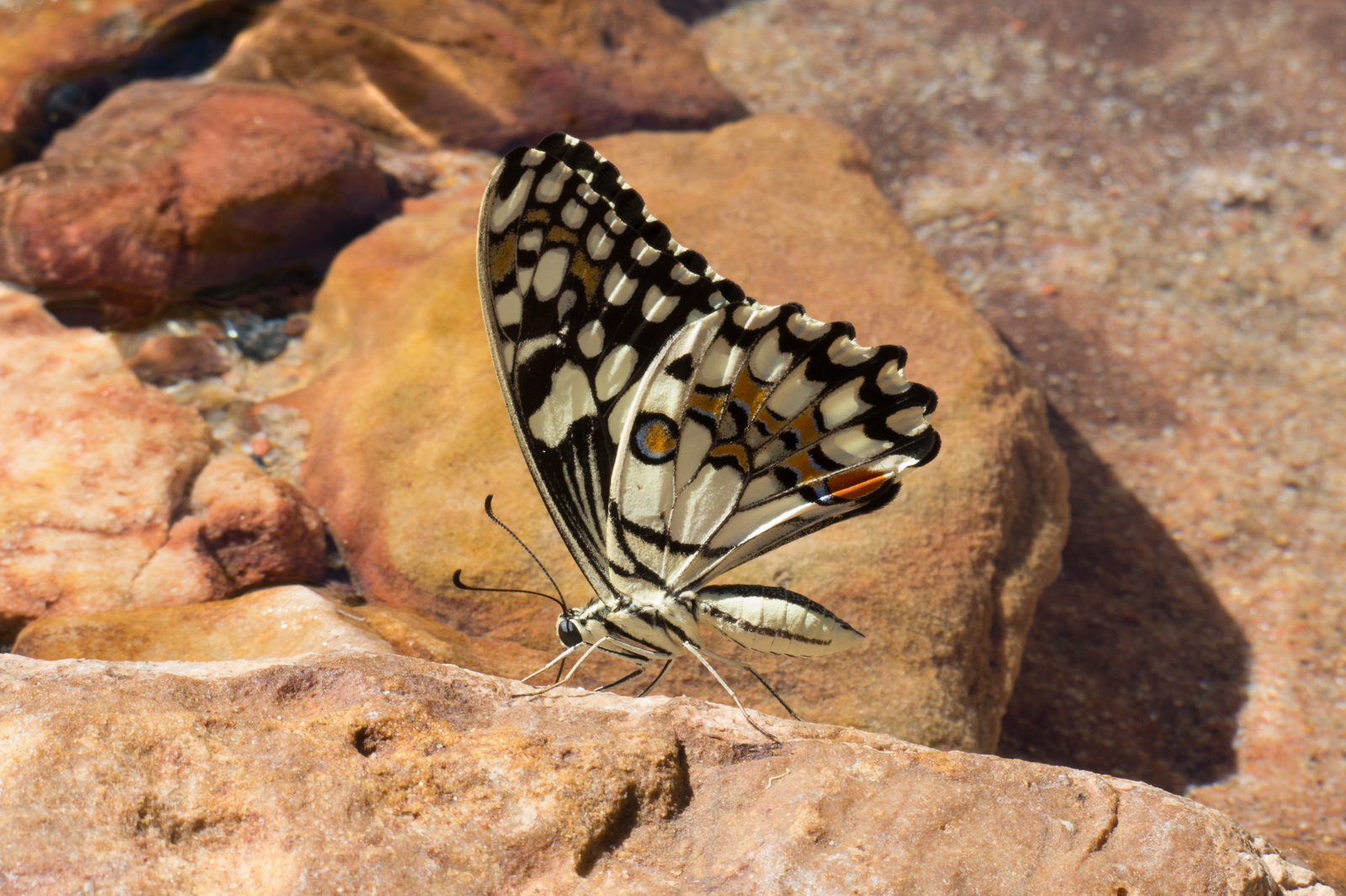
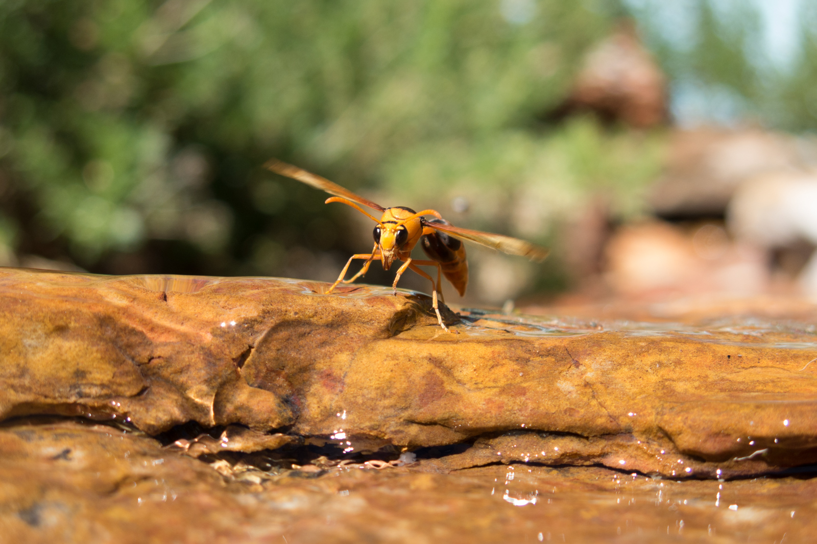
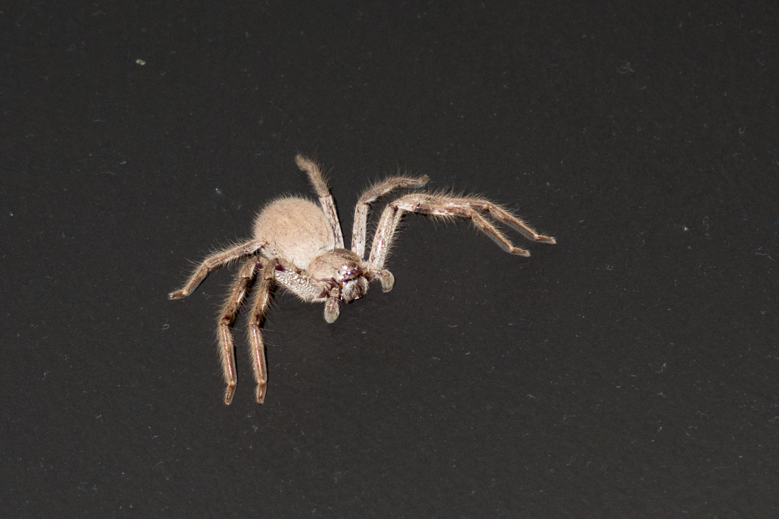
After a few hours in the heat, we spent the late afternoon at the pool. It featured a natural rock fountain and served as oasis for a number of thirsty insects. A wonderful opportunity to take some close-ups of butterflies and wasps, which appeared there in dozens. The spider on the right hand side is an overnight guest of our hotel room. I didn’t know you can get a flash red-eye effect even on a spider until I took a series of photos of this little fellow.
Butterfly at Kings Canyon Resort
Wasp at Kings Canyon Resort
Spider at Kings Canyon Resort
Towards sunset, we settled in at the viewing area again and indulged the colors of the sky and landscape as this side of the planet left the heat of the sun behind.
Kings Canyon sunset viewing area
The next morning, we packed up and hit the road for Alice Springs.
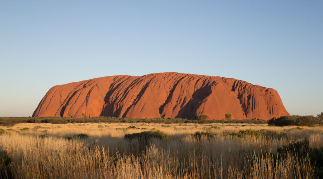
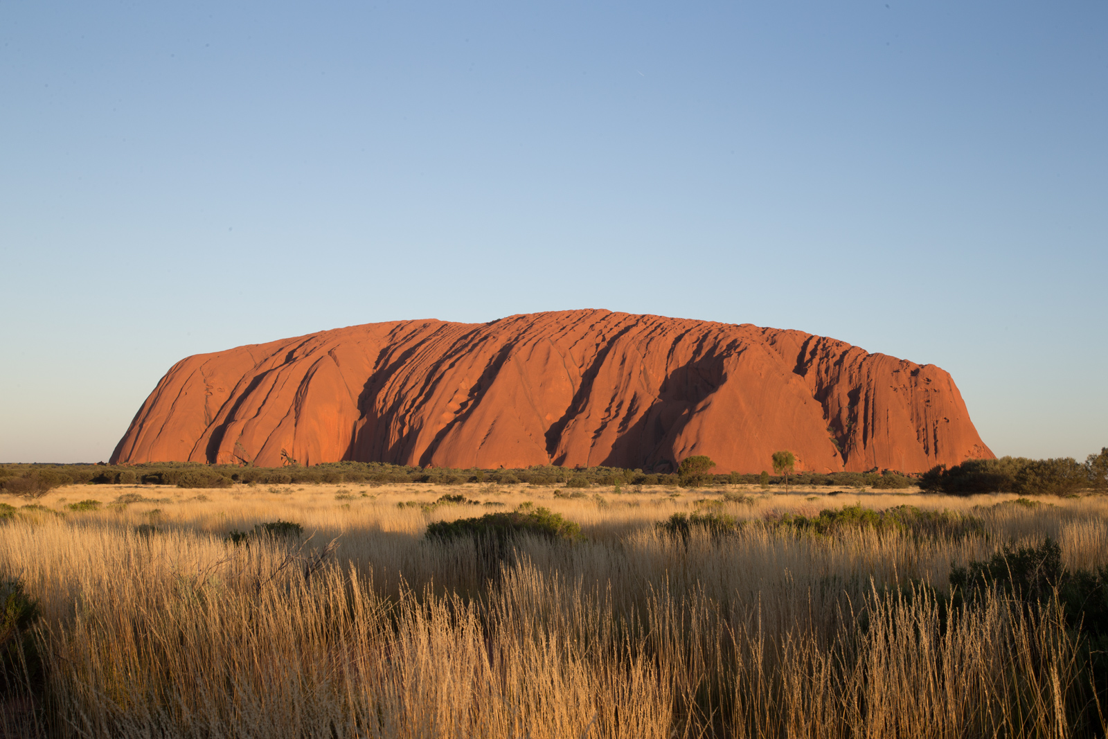
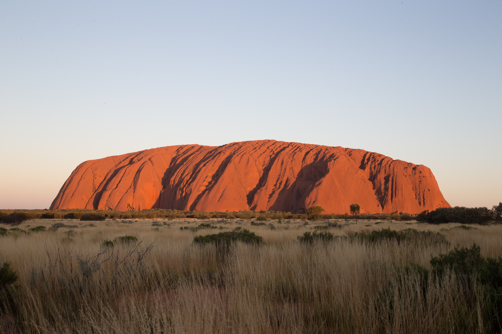
We planned to spend three nights at Ayers Rock and the Olgas. Since the drive from Erldunda Roadhouse to Ayers Rock resort takes just around three hours, we arrived around 1pm. At checkin, they refused an early checkin, so we had to take care of our little one in the reception hall including feeding and changing the nappies. With still more than enough time left until 3pm, we decided to go straight to Ayers Rock, or “The Rock” as it is referred to in Australia, as an Australian has told us.
We bought the park entry ticket at the park’s gate, which was valid for 72 hours. Ayers Rock was already well visible from the distance. It is a breathtaking view time and time again. We stopped by the Visitor Information Center in the National Park, which for some reason is called “Cultural Centre”. Perhaps due to the long texts of Aboriginal background information on display there – or the souvenir shop featuring ‘made in low-cost-country’ as well as locally manufactured pieces of remembrance.
“Sunset is great viewed from the sunset car park. Sunset today is at 19:23, so you want to be there at least 30mins before that.” the ranger in the visitor center said. He also provided helpful information about the Mala walk, a 90min ranger-guided walk starting at the Mala car park every day at 8am, as well as the Olgas.
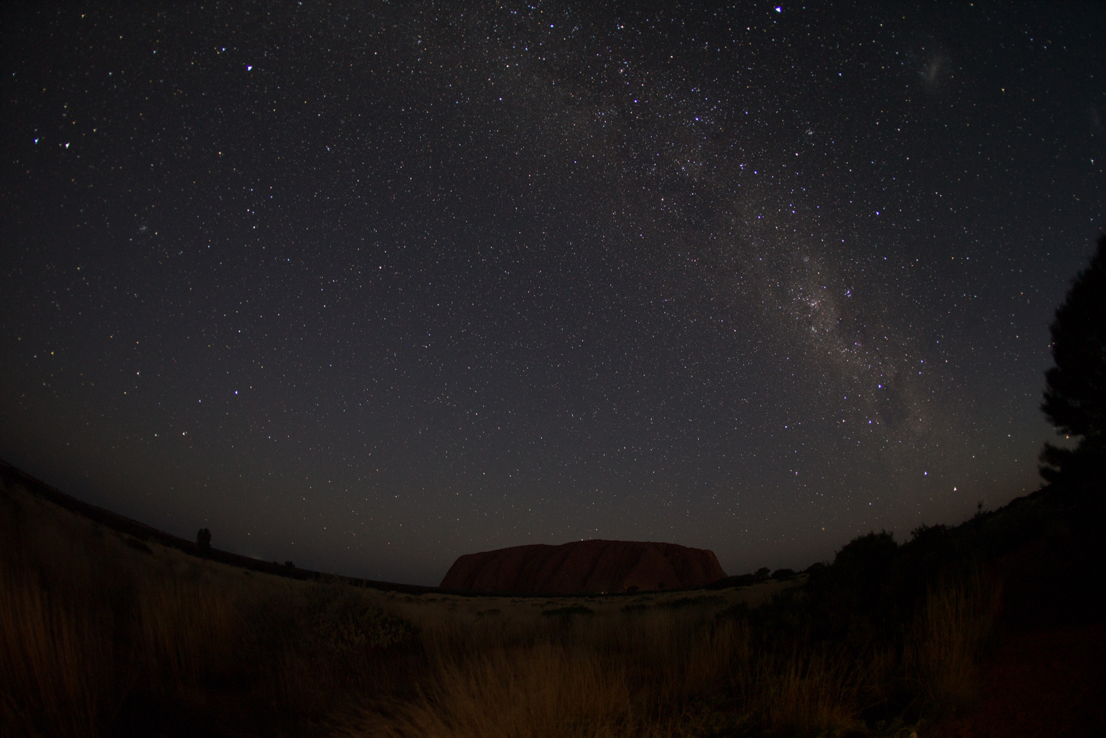
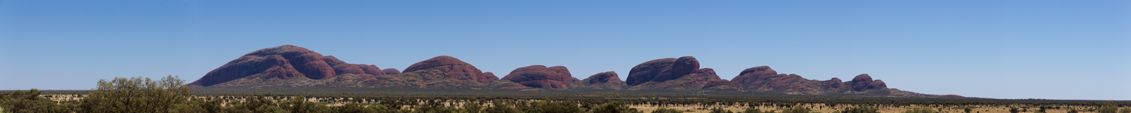
The Olgas are the second massive rock formation in Ayers Rock National Park. It’s characterized by deep valleys and gorges, which wind, water and sand have ground into the stone. We decided to drive around Ayers Rock this afternoon, then head back to the hotel for the check in just to go back to the Ayers Rock sunset viewing area. The park closes at 9pm and I was doing some night shots, one of which you can see below. At 20:30 a ranger stopped by to clear the car park, but thankfully gave me a ten minutes extension to take two more photos. If you are interested, the night shot was taken with an f=2.8 fisheye lens, bulb shutter at 45 seconds – tripod-based of course.
Sunset at Ayers Rock
Sunset at Ayers Rock
Ayers Rock by night
The next day, we joined the 8am Mala walk. It was a group of about 25 people following a ranger along the base of Ayers Rock while he explained some of the local fauna and flora as well as Aboriginal stories. Unfortunately, he explained, he couldn’t tell us some of the ‘other’ Aboriginal stories. The Aboriginal law says, you are only allowed to tell a story ‘where it happened’. So if you want to hear the story of a different place, you need to travel to that place. — I didn’t realize that the Aboriginal culture was an expert approach on tourism and marketing millenia ago. I learned it from that ranger.
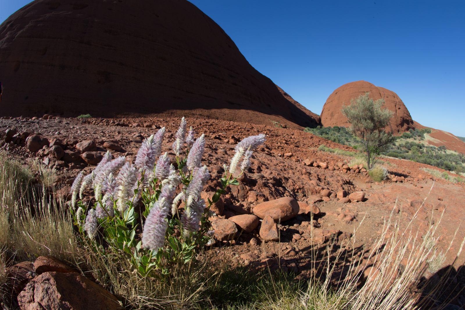
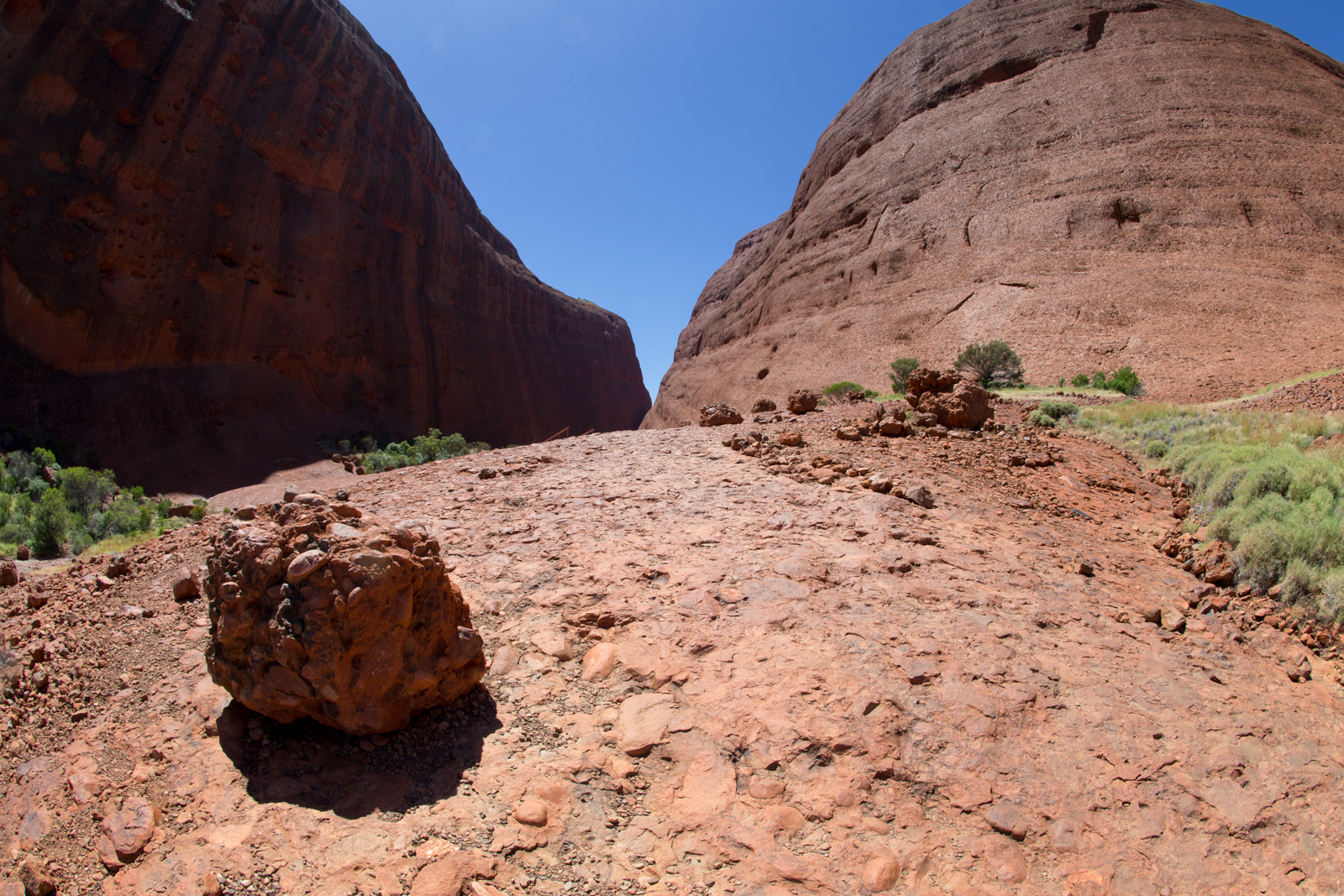
The Olgas
Later on, we ventured to the Olgas. We visited the Dune viewing area first. Just in time to feed our little one again. We tried hard, but hundreds of flies made this a very challenging experience. We needed fly nets. No question about it. So we decided to drive back to Ayers Rock and later on to the resort, where we got the nets at the local supermarket. Then we called it a day.
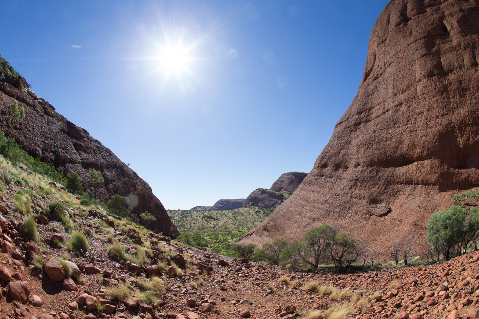
The Olgas
The Olgas – Valley of the Winds
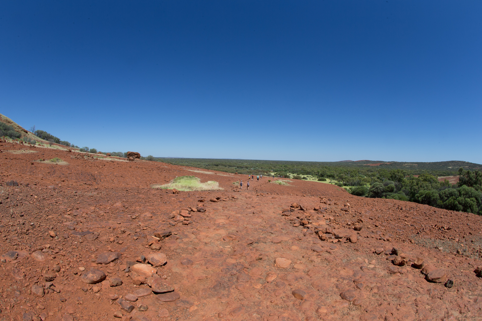
Next morning we started with a walk into the Valley of the Winds. The second part of the trail is closed after 11am, when the temperature is expected to exceed 36 degrees. Forecast said, it would get well above it on our day. Even though we began our walk at about 9am, we decided to stay safe and just go to the first lookout, which is considered ‘safe’ in any condition. We had to carry our little one, including all support items like food, nappies etc. as well as plenty of water. Valley of the Winds lived up to it’s name. There was a nice breeze at the lookout point. On the other hand, we probably lost a pound or two of body fluids to Amon-Ra the sun god.
Valley of the Winds
Valley of the Winds
Valley of the Winds
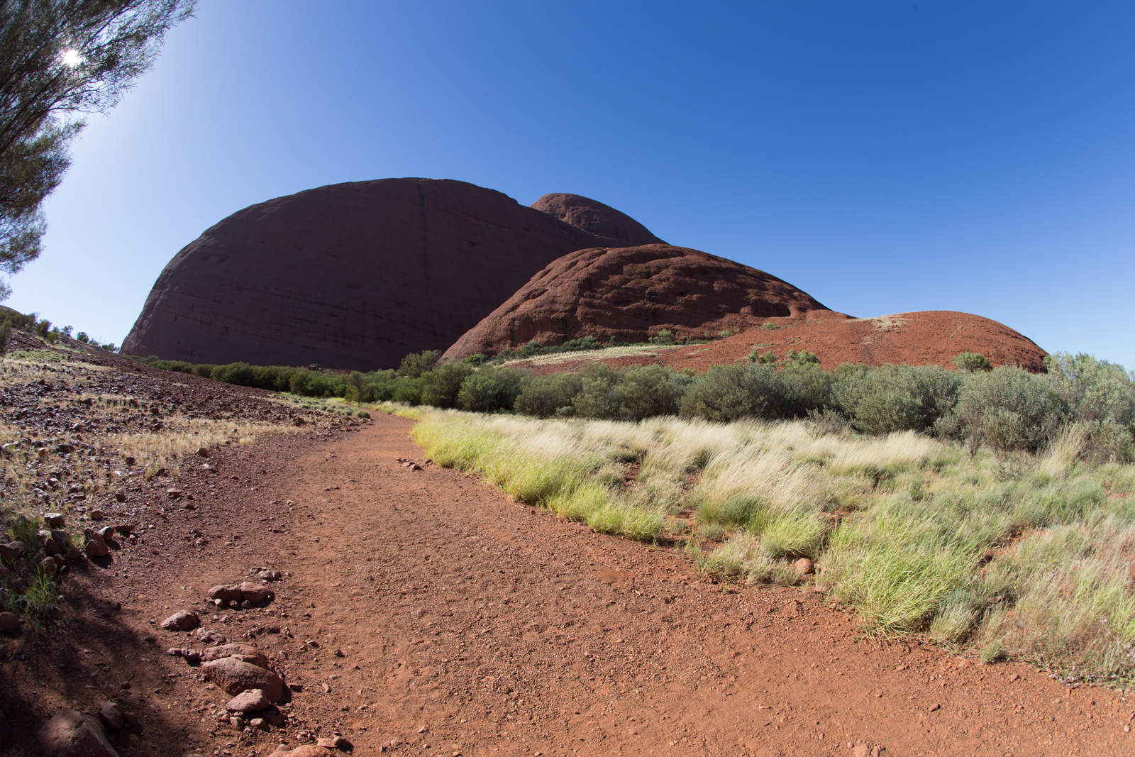
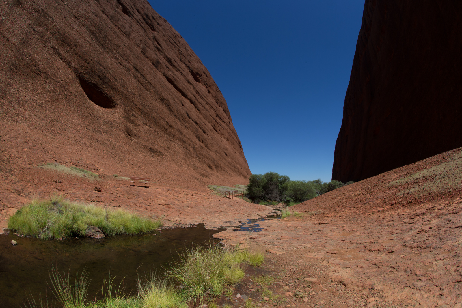
The Olgas – Walpa Gorge
We were feeling a bit revived as we drove the short distance from Valley of the Winds car park to Walpa Gorge. The gorge is actually a straight valley between the largest of the Olga’s rocks, which narrows towards its end. There, it provides shade for a tiny waterhole, just enough to host a few plants and zebra finches.
Walpa Gorge
Walpa Gorge
Walpa Gorge
At the end of this second walk, we were exhausted by the heat and decided to go back to the hotel and refresh a bit in the pool, just to be ready for another sunset viewing of Ayers Rock. The next day, we would be at Kings Canyons.
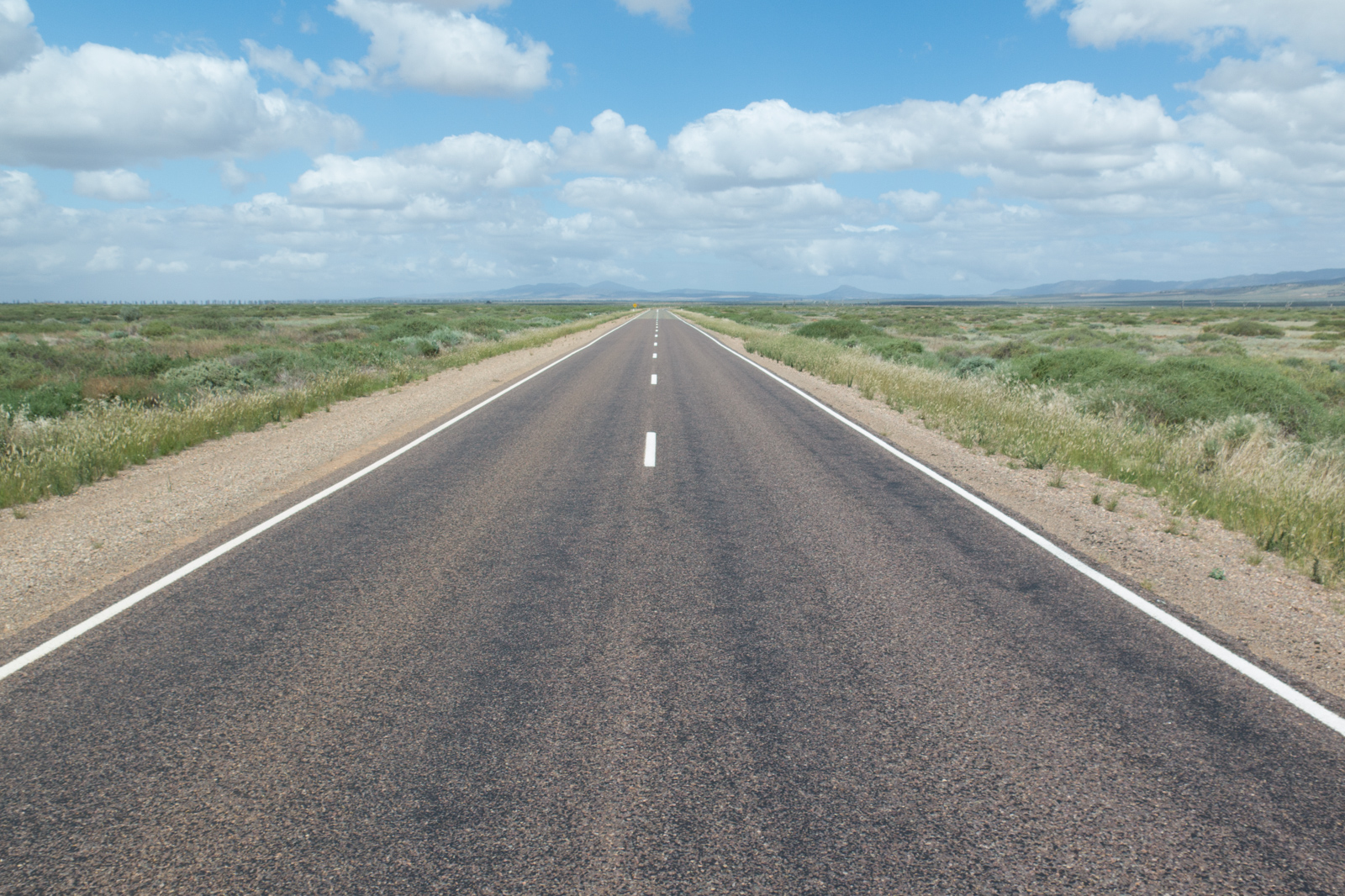
Our 540km drive from Port Augusta to Coober Pedy, Australia’s Opal city, was rather uneventful except for a stop at Glendambo Roadhouse for a feeding break and refueling.
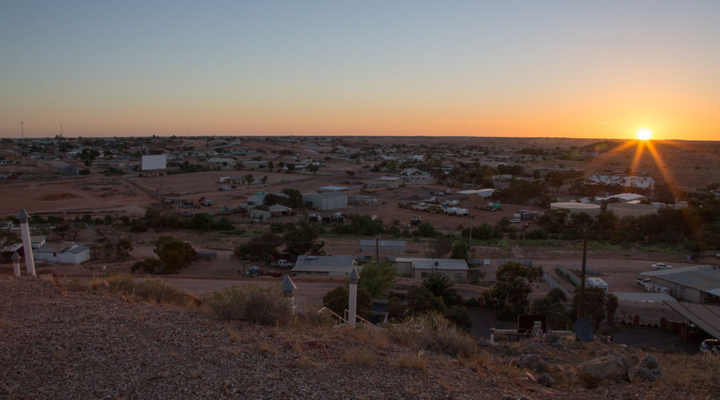
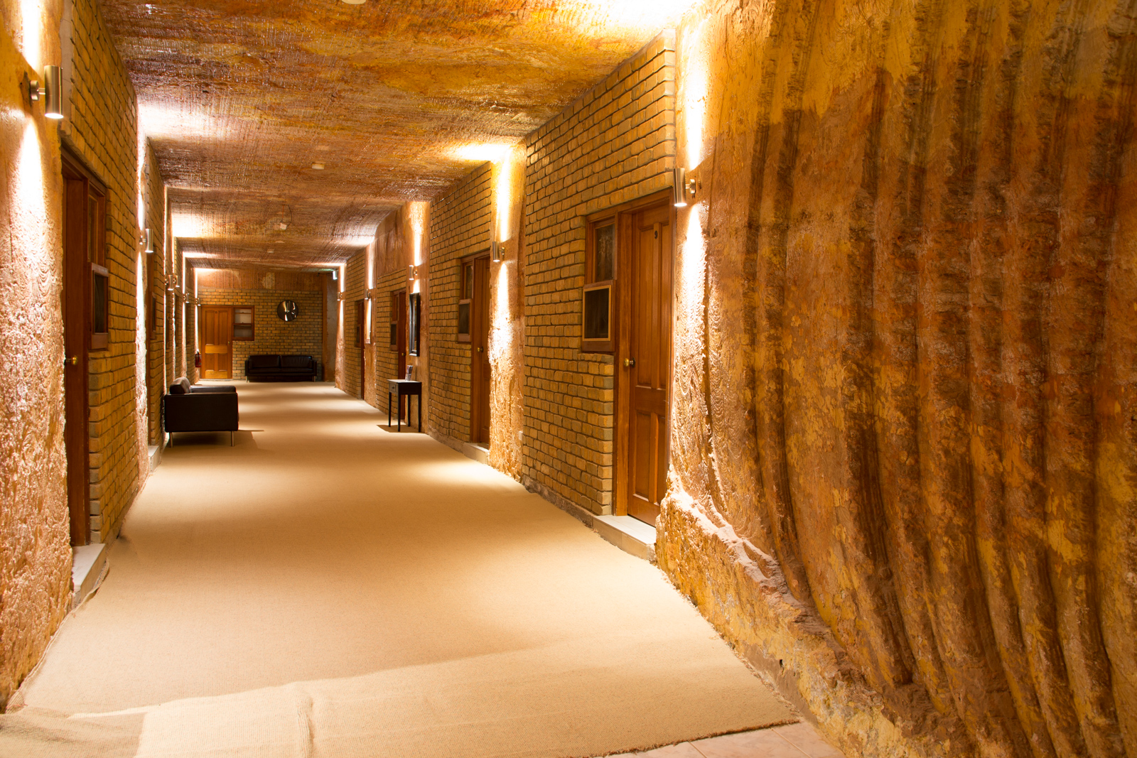
We arrived late afternoon in Coober Pedy, early enough to check into one of the underground accommodations – or dugouts as they are called here – and take a tour around the town.
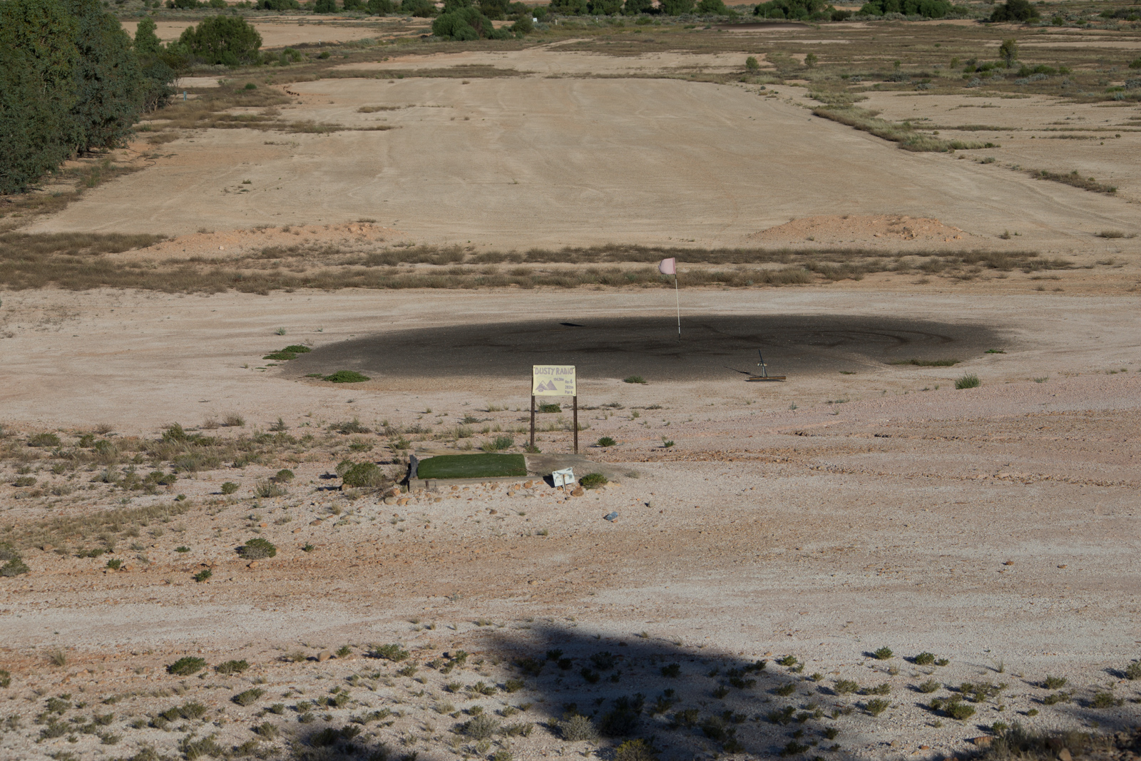
The famous golf club of Coober Pedy is worth taking a look at – regardless of whether your handicap is four or you feel handicapped for golfing overall, like I do. The teeing grounds are small patches of artificial lawn and the greens are the ‘greys’. Grass is no where to be seen on the entire course. The entire plot looks like the next Madmax edition of a grand sandrock-mole competition.
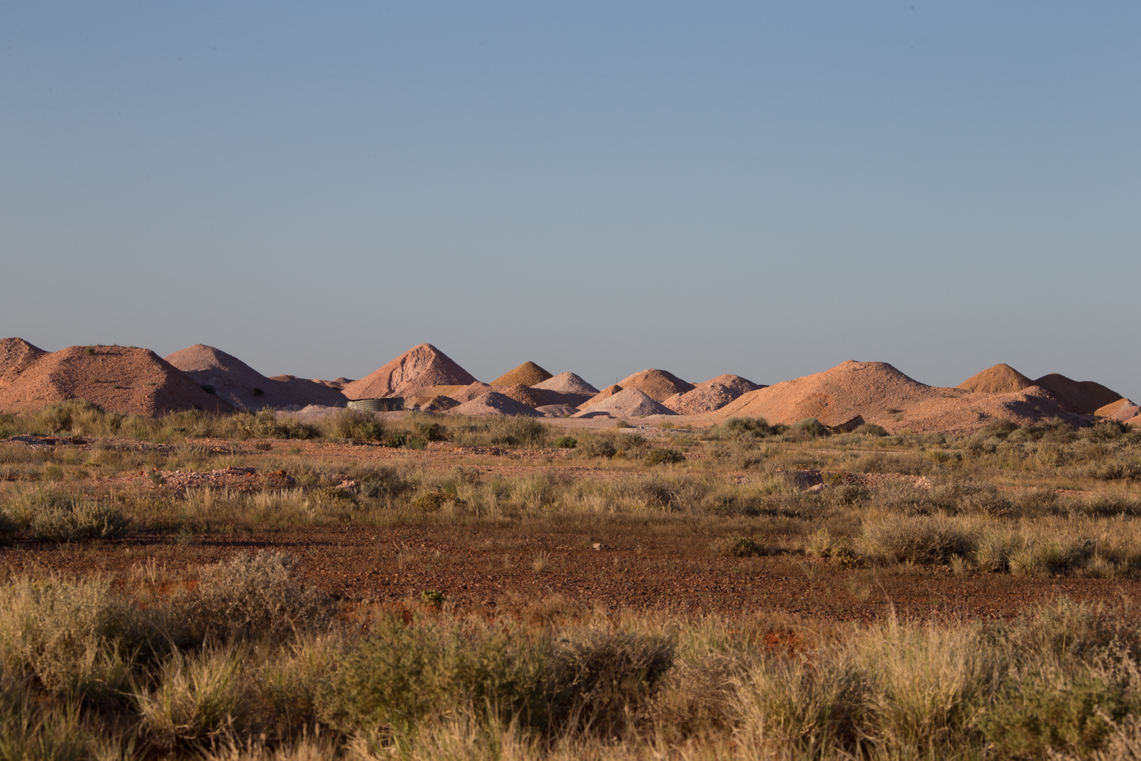
As the evening sun sent its red rays of goodbye from the horizon we admired the piles of rubble, which started to glow in all shades of white, yellow, orange and light red. It looks a bit like a landing site of extraterrestrial ants, who attempt to colonize the planet. As ugly as the sites are during bright, unforgiving daylight as marvelous the scenery becomes when the soft evening light brings out the colors.
Coober Pedy Golf Club
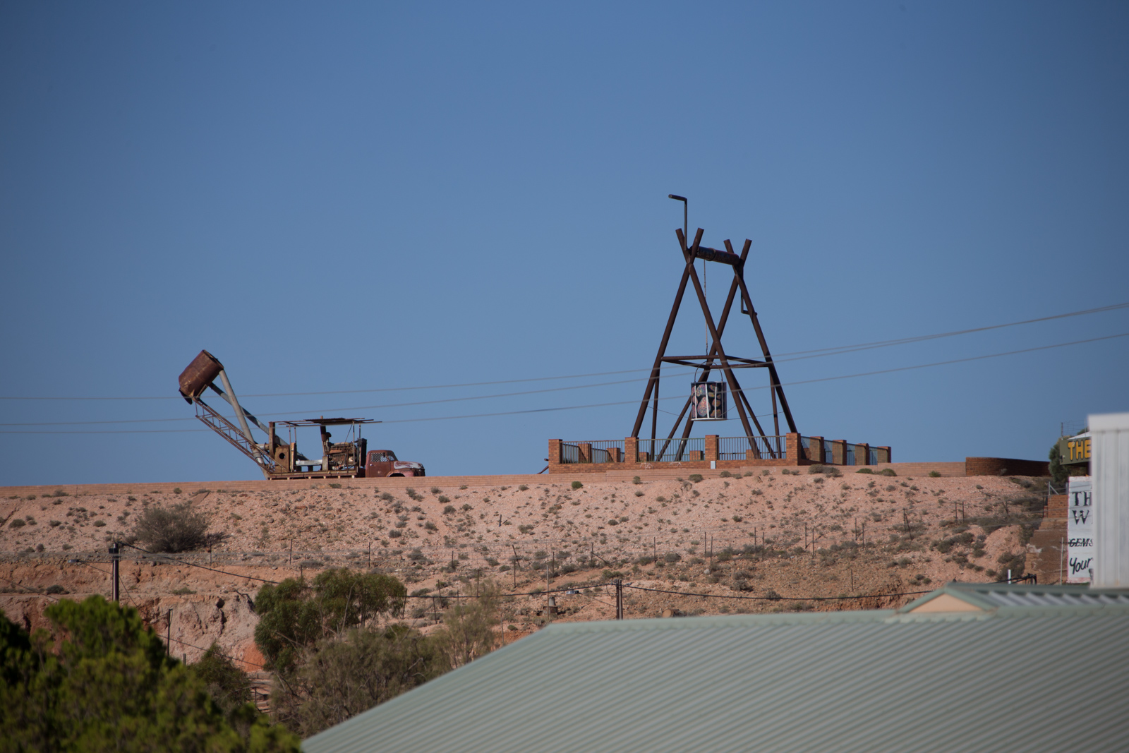
Coober Pedy
An undeground motel in Coober Pedy
The next day, we ventured to the Umoona Opal Mine and Museum. You get a 20min tour through the dugout with a bit of background information on the place and opal mining in general. Our tour guide was Rudi, an eighty-plus years old Austrian, who has spent most of his life chasing opals. When the tour ends, there is an optional video viewing with “Q&A”. Go for that one. It’s by far the most interesting and entertaining part of the museum.
When Rudi is in the mood. He talks about some of the opals and miners featured in the video and little stories that go with it. “I know this Opal buyer well. In the old days he had three fridges of cold beer in his office. And regardless of how big your parcel [set of raw opals] was, we used to empty those fridges after the deal was closed.”
The video rolled on and he caught the sight of an opal he truly admired. It’s a former squid bone, which decomposed in million of years underground and made room for the silica gemstone. “If I had found it, I would have kept it for my life and have it buried with me in my grave.” he uttered. “It’s so beautiful but almost impossible to grade [its value].”
Coober Pedy Mining Equipment
Then he gets into the old times. “My buddy and I were heavy drinkers. On a Saturday evening, when we were in the mood, I drank 12 liters of wine.” Rudi says and you know he is not exaggerating. “My buddy died from it. His heart didn’t make it one day. I went sober that day. Cold turkey, you know. Never had a drop of alcohol ever since.” He also has hilarious stories to tell about the ‘good old days’ local police versus the outsiders from highway patrol. As you can imagine this story also included more than one intoxicated driver. Listening to his tales of Opal miners more than an hour flew by quickly. Unfortunately, we needed to leave and hit the road for Erldunda, our final stop of the day before we reached Ayers Rock and the Olgas.
From Coober Pedy to Erldunda
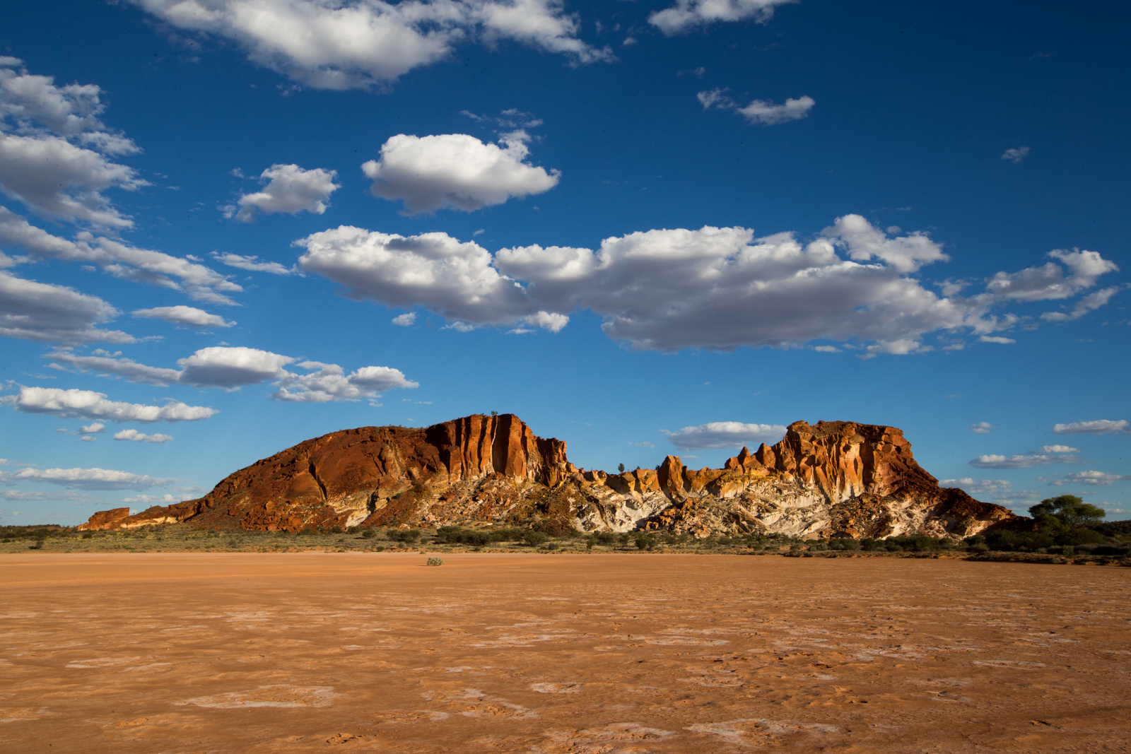
Following the Stuart Highway north for a few kilometers, we took a right turn onto a dirt road to the Breakaways. At the end of the 10km long road, there is an elevated lookout at the rim of colorful stone cliffs. It’s worth if you have ample time for sightseeing, but can skip if you are short on time.
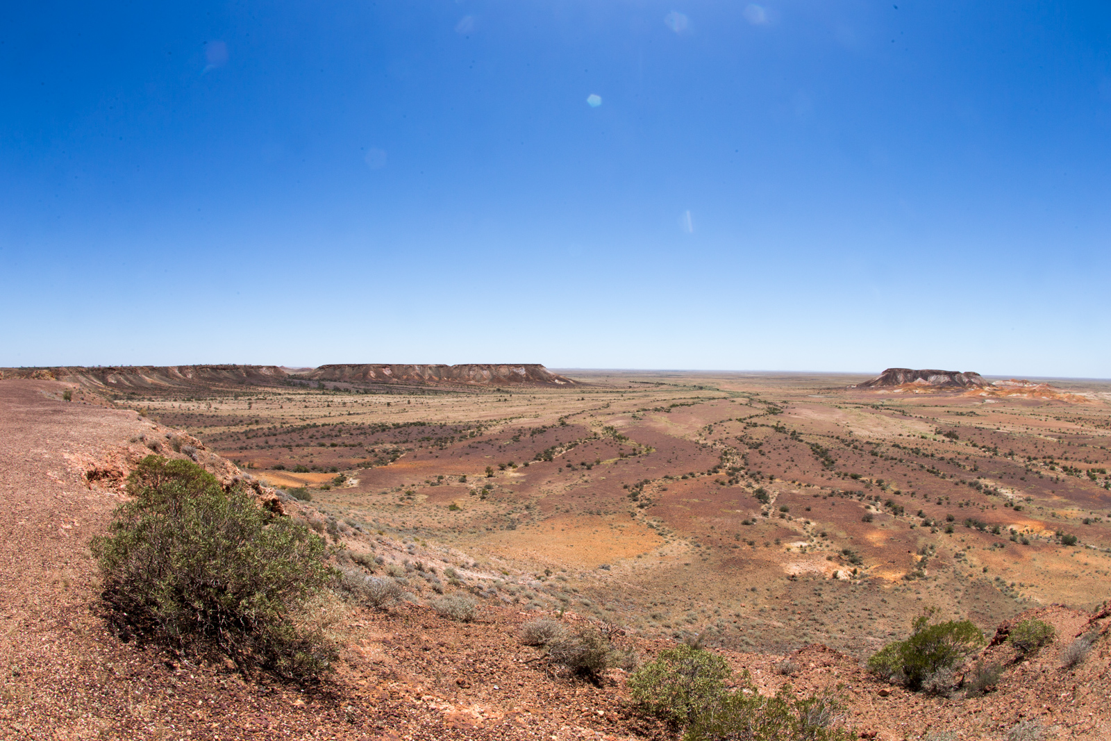
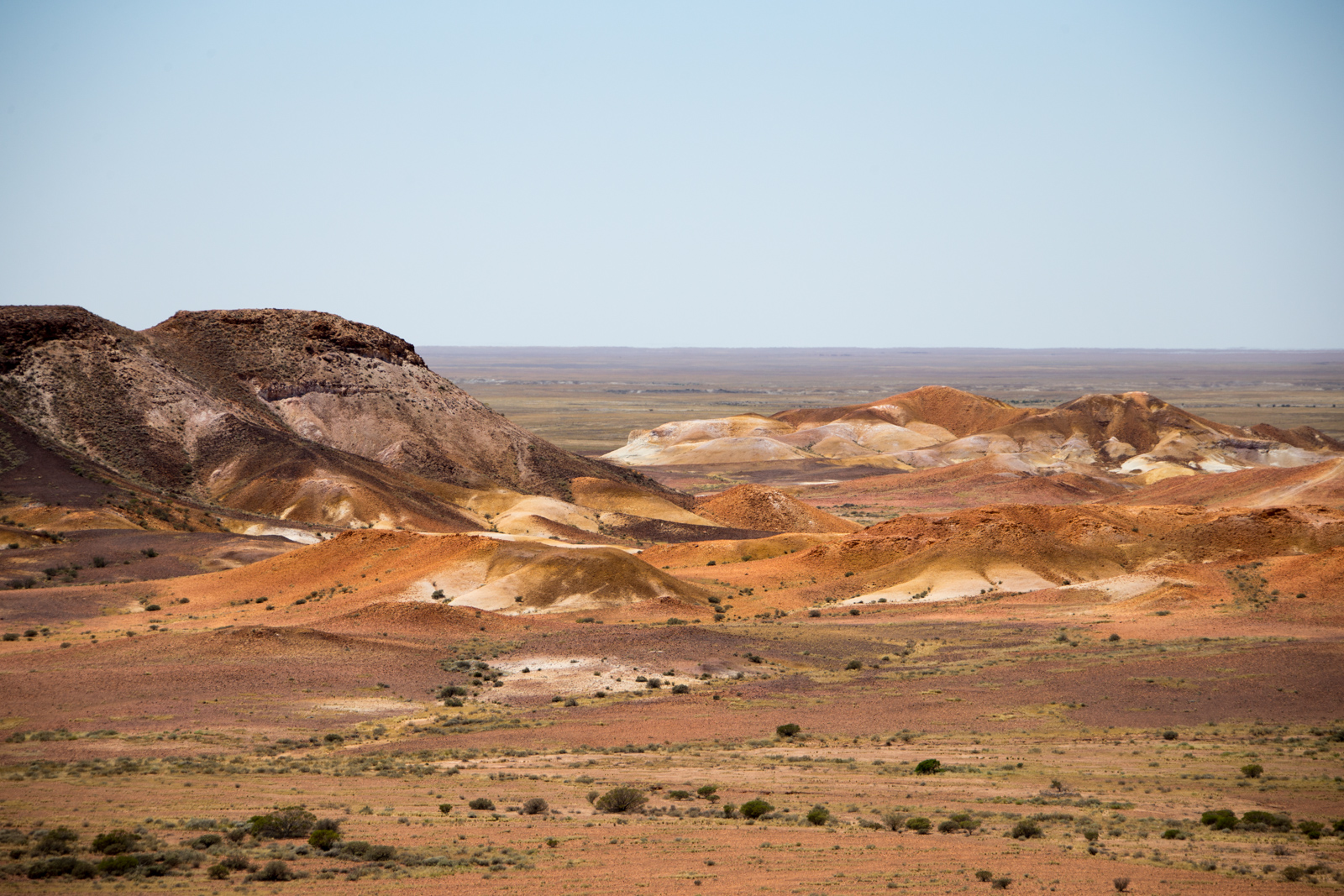
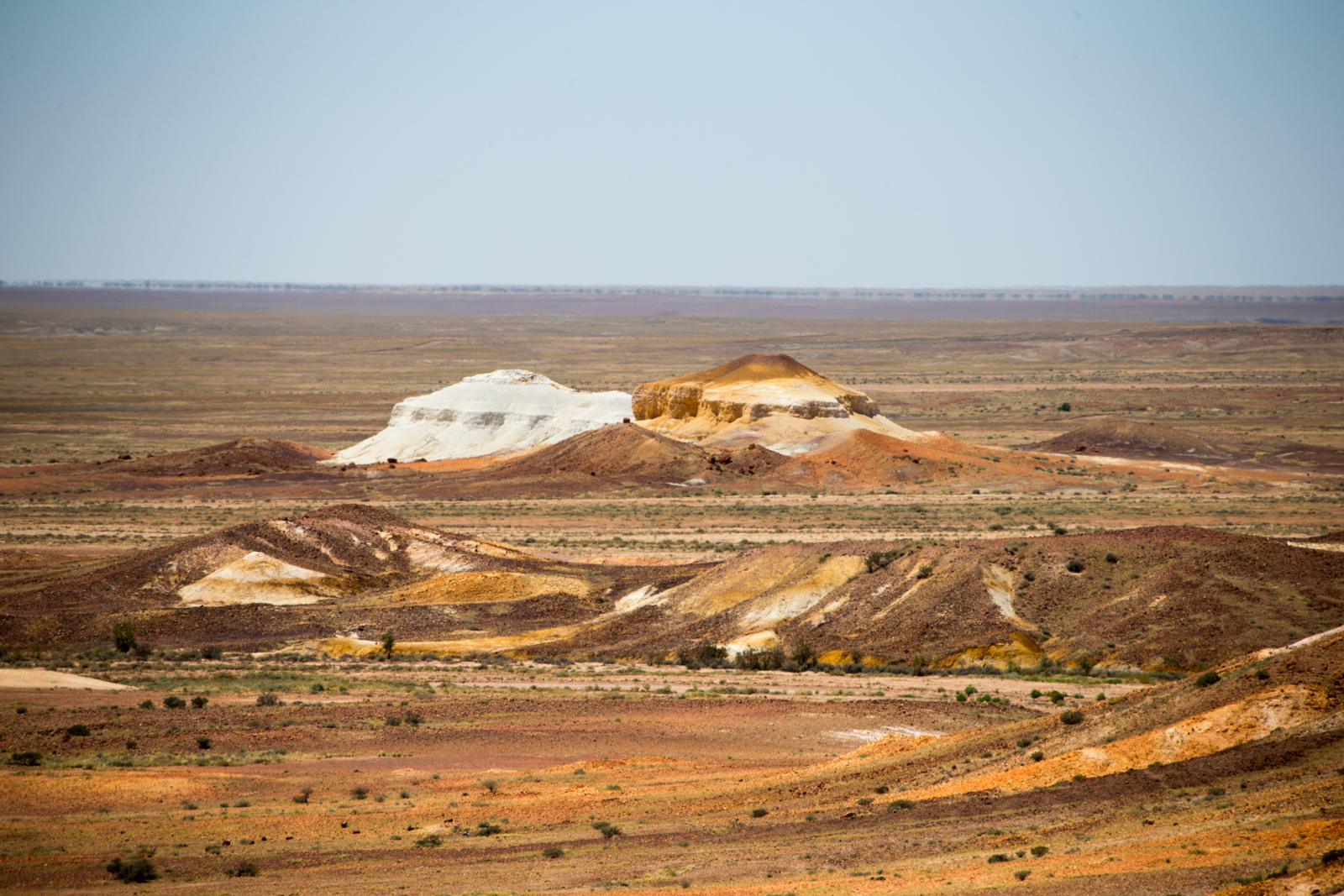
The Breakaways near Coober Pedy
The Breakaways near Coober Pedy
The Breakaways near Coober Pedy
In the evening we arrived at the Erldunda Roadhouse. At night we happen to sit for a minute in front of the reception area. It was just the three of us amongst a couple of benches and tables. I was holding our little one who was looking over my shoulder. At one point I noticed she was following something on the ground with her eyes. When I followed her gaze, I noticed a small ant making her way across the concrete floor. Good eyes sweetie! Only then I noticed the movement not far away from the ant and saw the tail of a snake disappearing under our table. It ventured from our table towards the main building and disappeared in one of the drains for rainwater. We double checked our room for snakes that night.
A “pest control program” by the National Park Authorities of the Flinders Ranges was about to end that night at 9pm. All main access roads were open already. So we traveled towards Wilpena Pound, where we had our base camp for the next three nights.
Quorn, Hawker, Moralana Gorge Road
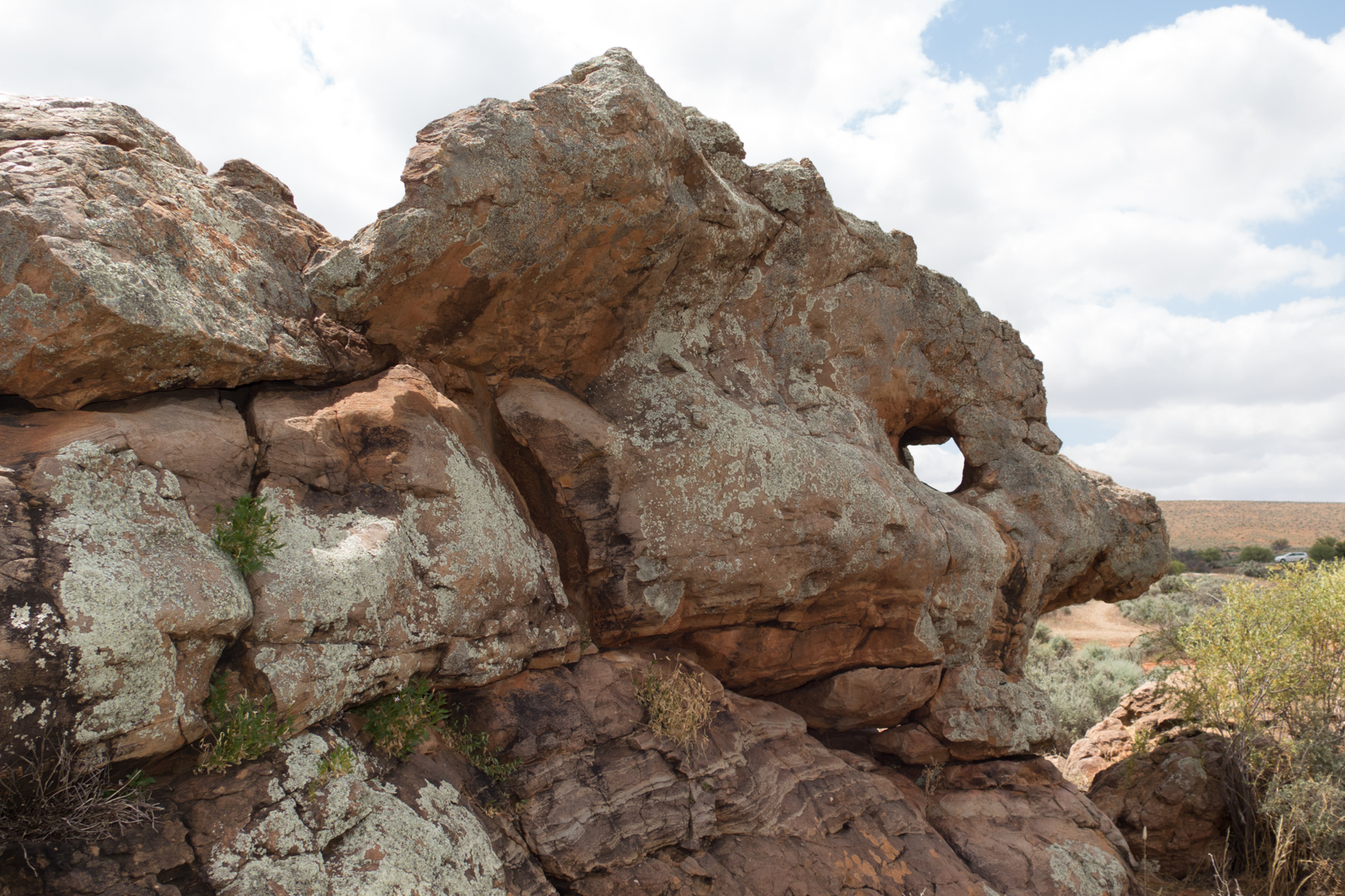
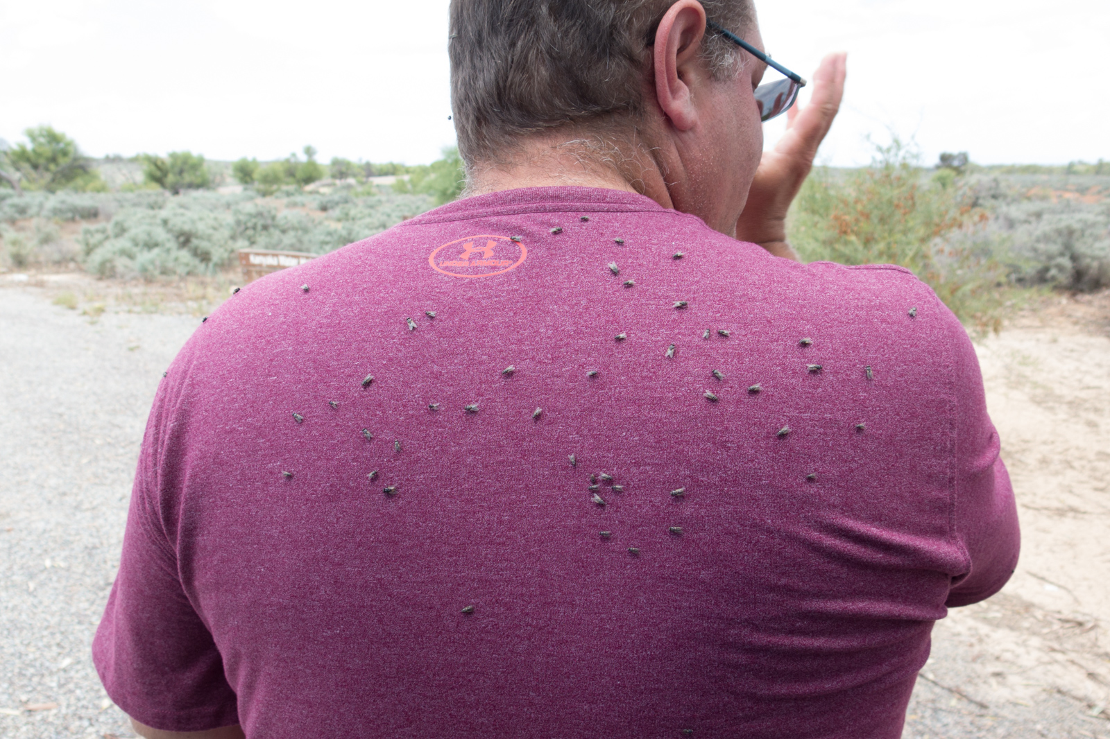
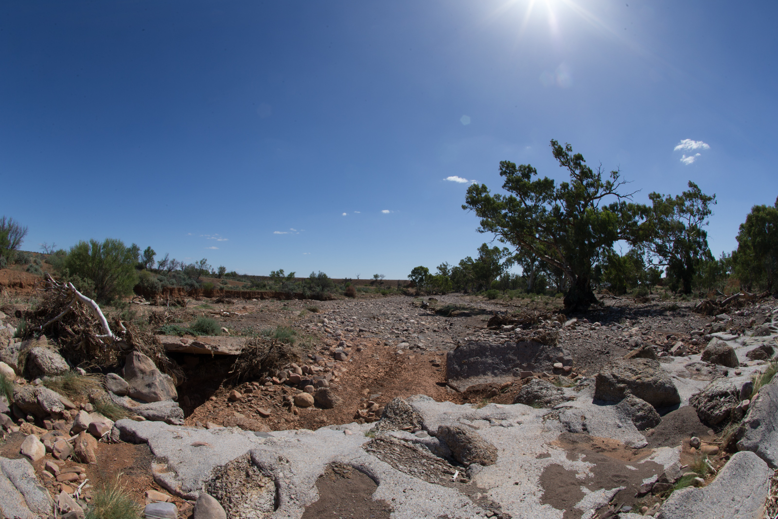
From Port Augusta we took The Outback Highway (B83) north. The traffic was very light, so there was a lot of opportunity to stop on the side of the road or do short walks. We drove through Quorn, where time seems on its own trajectory since the early 1900’s. About half way between Quorn and Hawker, we did a short walk to the Kanyaka Waterhole. Be warned – use a fly-net if you have one at hand. The flies there were from the persistent breed, at least when we traveled the area in February.
The Outback Highway
Rocks at Kanyaka Waterhole
Flies at Kanyaka Waterhole
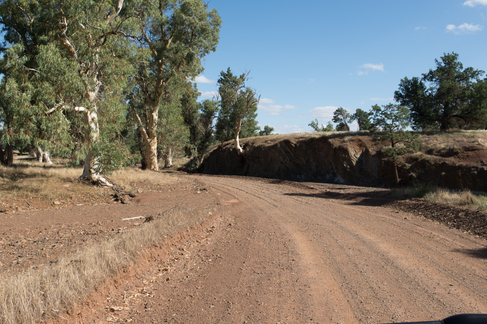
We did a feed-our-little-one stop in Hawker and met a Netherlandish-German couple, who run the Sightseers Cafe. We continued to head north on The Outback Highway for about 43km, then took a right turn onto Moralana Gorge Road. This unsealed road coasts along the southern end of Flinders National Park and meets the Flinders Ranges Way a few kilometers before the park’s entrance.
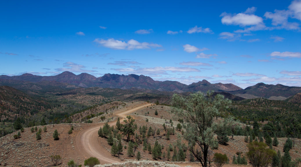
Moralana Gorge Road is a relatively easy driving road for 4WD. We even saw one or two 2WDs on our way. This road has been one of the highlights of our trip so far. Countless roos and emus – and a breathtaking scenery with ever changing landscapes. At one moment we were chatting in the car: “You know, this valley reminds me of Jurassic Park. You remember the scene, where there were herds of dinosaurs grazing peacefully in the golden sun.” “Yes, exactly like it looks here.” – So if you happen to go to Flinders, don’t miss this part outside the national park.
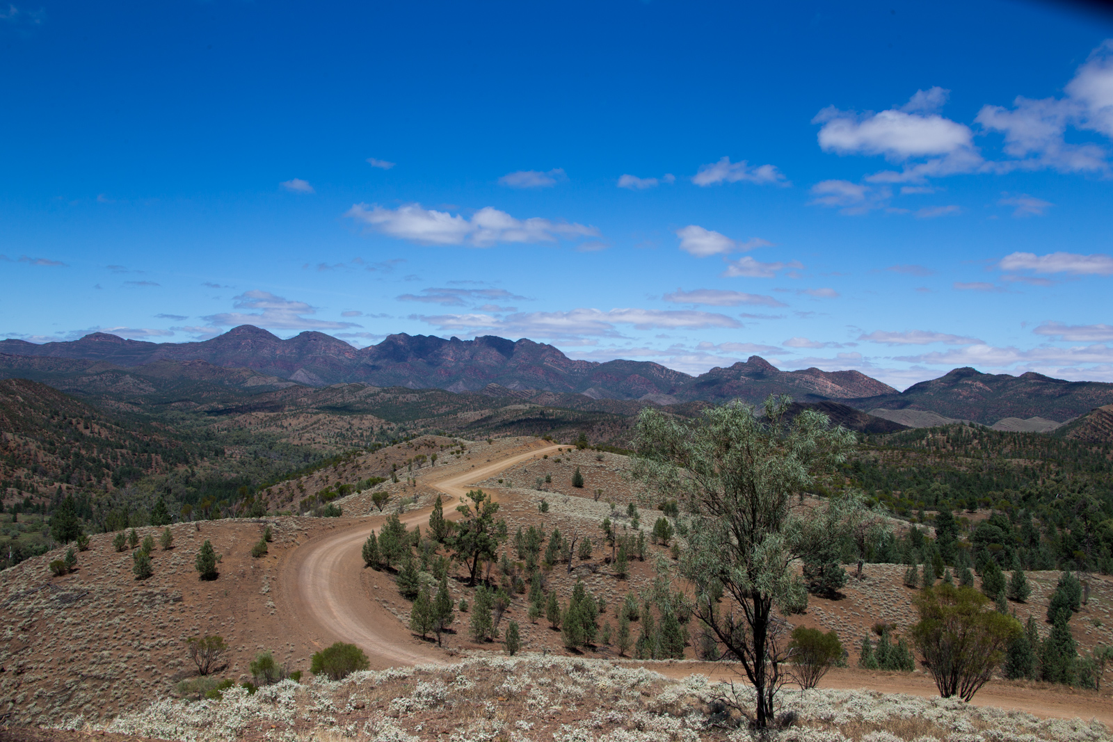
Bunyeroo Road, Brachina Gorge
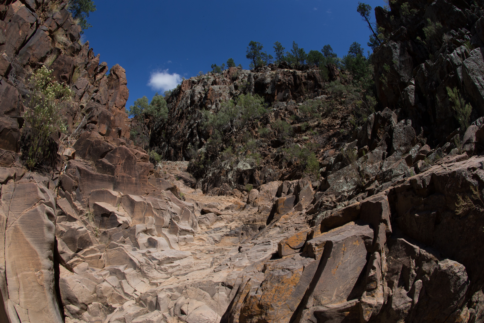
The next day, we set out for Bunyeroo Road from south to north until it meets the Brachina Gorge Road. Both are unsealed and both are worth experiencing. The road conditions were good as it was dry season. Both roads offer spectacular views along the creek beds with impressive stone formations and huge eucalyptus trees. That day, we also had the pleasure to help a Swiss traveler, who got stuck with his 2WD camper as he tried to make a 180 degree turn just where the road was going through the riverbed.
Bunyeroo Road
Bunyeroo Road
Brachina Gorge Road
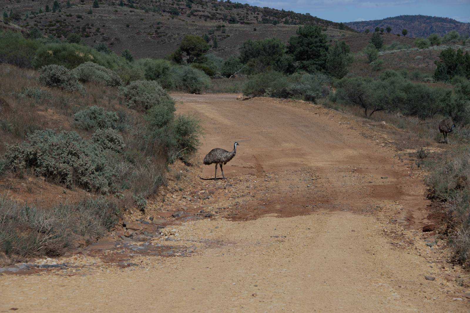
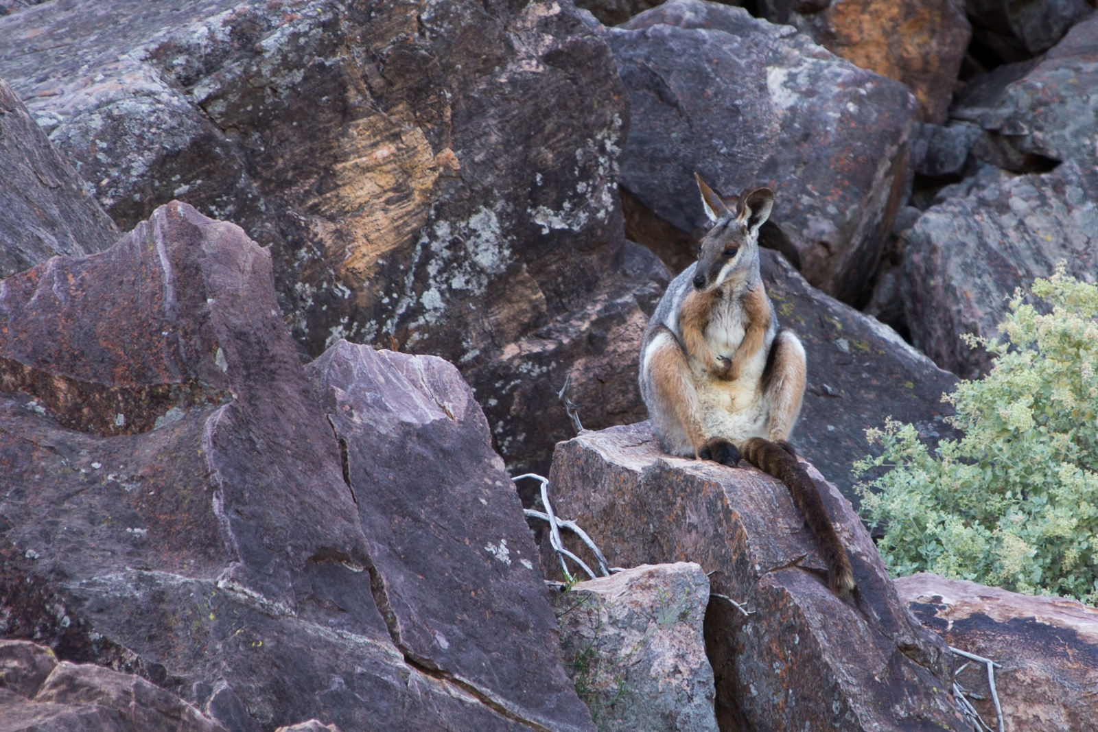
Where Bunyeroo Road meets Brachina Gorge Road, we took a left turn into Brachina Gorge and followed it through to the end of the valley, then we turned around and went Brachina Gorge Road all the way back to Flinders Ranges Way. Views and wildlife were phenomenal. We saw about three to four times more roos and emus than we saw cars for the whole day. One of the highlights in Brachina Gorge was the sight of a Yellow-footed Rock Wallaby. They were almost extinct and are still on the endangered species list.
Yellow-footed Rock Wallaby
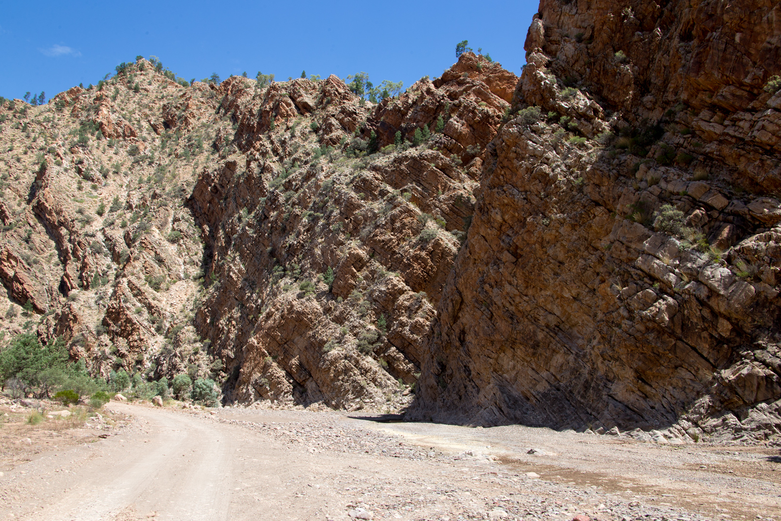
Sacred Canyon
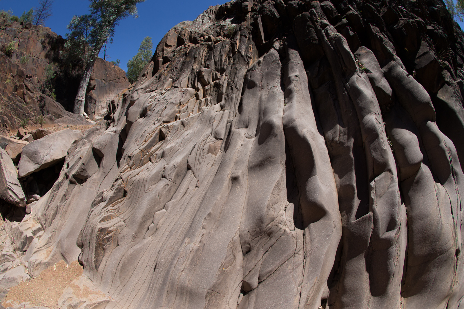
On our last day in the Flinders National Park, we explored the Sacred Canyon, which is another unsealed road in good condition and an easy drive with a 4WD. Sacred Canyon is a 10mins walk from the car park through the river bed. The river narrows to a small gorge which you can climb through during dry season. Towards the upper end of the gorge there are old Aboriginal paintings, which were very difficult to see, and a cave shelter. The truly impressive sight there though are the rock formations.
Sacred Canyon, Flinders
Sacred Canyon, Flinders
Sacred Canyon, Flinders
The following hours we drove on Flinders Ranges Way until a flat tire stopped our adventure. After mounting the spare tire for one hour we decided to call it a day and headed back to Wilpena Pound.
Back to Port Augusta
We started back to Port Augusta late morning the next day. At the Mogas station in Hawker a taciturn bloke fixed our punctured tire in less than half an hour. During the whole procedure he might have said two, maybe there words. G’day or hello was not one of them. But he did a good job on the tire. After this short stop we drove back to Port Augusta, where we replenished water and other supplies. We were about to head into the Red Centre the next day with Coober Pedy as our first stop.
by Christopher Daerr
This website uses cookies to improve your experience. We'll assume you're ok with this, but you can opt-out if you wish.AcceptPrivacy Policy
Privacy & Cookies Policy
Privacy Overview
This website uses cookies to improve your experience while you navigate through the website. Out of these, the cookies that are categorized as necessary are stored on your browser as they are essential for the working of basic functionalities of the website. We also use third-party cookies that help us analyze and understand how you use this website. These cookies will be stored in your browser only with your consent. You also have the option to opt-out of these cookies. But opting out of some of these cookies may affect your browsing experience.
Necessary cookies are absolutely essential for the website to function properly. This category only includes cookies that ensures basic functionalities and security features of the website. These cookies do not store any personal information.
Any cookies that may not be particularly necessary for the website to function and is used specifically to collect user personal data via analytics, ads, other embedded contents are termed as non-necessary cookies. It is mandatory to procure user consent prior to running these cookies on your website.